Pont-à-Celles geodata
Pont-à-Celles (Wallonia) is a populated place; located in Belgium in Europe/Brussels (GMT+2) time zone. With population of 15,909 people, there are 175 cities with bigger population in this country. Compared to other cities in Belgium, 76.7% of cities are located further ↑North; 60.6% of cities are located further →East and 73.5% of cities have lower elevation than Pont-à-Celles. Note1
Administrative division(s):
- Level 1: Wallonia
- Level 2: Province du Hainaut
- Level 3: Arrondissement de Charleroi
- Level 4: Pont-à-Celles


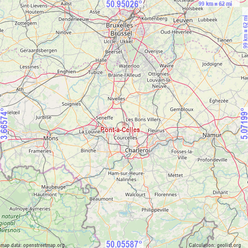
Pont-à-Celles GPS coordinates[2]
50° 30' 18.648" North, 4° 22' 7.932" East
| Map corner | latitude | longitude |
|---|---|---|
| Upper-left | 50.95026°, | 3.66574° |
| Center: | 50.50518°, | 4.36887° |
| Lower-right: | 50.05587°, | 5.07199° |
| Map W x H: | 99.4×99.4 km | = 61.8×61.8mi |
| max Lat: | 51.46791° ⇑76.7% North |
| Pont-à-Celles: | 50.50518° |
| min Lat: | ⇓23.3% South 49.53771° |
| min Long | Pont-à-Celles | max Long |
| 2.59368° | 4.36887° | 6.25749° |
| W 39.4%⇐ | ⇒60.6% E |
Elevation
Elevation of Pont-à-Celles is 137 m = 449 ft, and this is 37.5 m = 123 ft above average elevation for this country.
| Max E: |
582 m = 1909 ft | 26.5% |
| Pont-à-Celles | 137 m 449 ft | |
| Avg. | 99.5 m = 326 ft | |
Min E: |
1 m = 3 ft | 73.5% |
See also: Belgium elevation on elevation.city.
Geographical zone
Pont-à-Celles is located in North temperate zone (between Tropic of Cancer and the Arctic Circle). Distance of this North polar circle is 1785.5 km =1109.5 mi to North.| Distance of | km | miles | from Pont-à-Celles |
|---|---|---|---|
| North Pole | 4391.4 | 2728.7 | to North |
| Arctic Circle | 1785.5 | 1109.5 | to North |
| Tropic Cancer | 3009.7 | 1870.1 | to South |
| Equator | 5615.6 | 3489.4 | to South |


Nearby cities:
15 places around Pont-à-Celles: (largest is in red/bold)
• Anderlues
12.9 km =8 mi,  212°
212°
• Brunehault
4.5 km =2.8 mi,  89°
89°
• Chapelle-lez-Herlaimont
7.2 km =4.5 mi,  238°
238°
• Charleroi
11.7 km =7.3 mi,  152°
152°
• Châtelet
16 km =9.9 mi,  135°
135°
• Courcelles
4.6 km =2.9 mi,  174°
174°
• Farciennes
14.8 km =9.2 mi,  124°
124°
• Fleurus
13 km =8.1 mi,  100°
100°
• Genappe
13.2 km =8.2 mi,  26°
26°
• La Louvière
13 km =8.1 mi,  260°
260°
• Manage
9.4 km =5.8 mi,  268°
268°
• Morlanwelz-Mariemont
10.4 km =6.5 mi, 237°
• Nivelles
10.7 km =6.6 mi,  344°
344°
• Seneffe
8 km =5 mi,  291°
291°
• Villers-la-Ville
12.5 km =7.8 mi,  56°
56°
Sources, notices
• [Note1] Compared only with cities in Belgium existing in our database
• [Src1] Map data: © OpenStreetMap contributors (CC-BY-SA)
• [Src2] Other city data from geonames.org with taken over terms of usage.
• [Src3] Geographical zone / Annual Mean Temperature by Robert A. Rohde @ Wikipedia
