Thuin geodata
Thuin (Wallonia) is a populated place; located in Belgium in Europe/Brussels (GMT+2) time zone. With population of 14,682 people, there are 188 cities with bigger population in this country. Compared to other cities in Belgium, 87.4% of cities are located further ↑North; 64.8% of cities are located further →East and 76.9% of cities have lower elevation than Thuin. Note1
Administrative division(s):
- Level 1: Wallonia
- Level 2: Province du Hainaut
- Level 3: Arrondissement de Thuin
- Level 4: Thuin


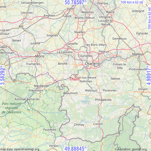
Thuin GPS coordinates[2]
50° 20' 21.588" North, 4° 17' 9.744" East
| Map corner | latitude | longitude |
|---|---|---|
| Upper-left | 50.78597°, | 3.58292° |
| Center: | 50.33933°, | 4.28604° |
| Lower-right: | 49.88845°, | 4.98917° |
| Map W x H: | 99.8×99.8 km | = 62×62mi |
| max Lat: | 51.46791° ⇑87.4% North |
| Thuin: | 50.33933° |
| min Lat: | ⇓12.6% South 49.53771° |
| min Long | Thuin | max Long |
| 2.59368° | 4.28604° | 6.25749° |
| W 35.2%⇐ | ⇒64.8% E |
Elevation
Elevation of Thuin is 156 m = 512 ft, and this is 56.5 m = 185 ft above average elevation for this country.
| Max E: |
582 m = 1909 ft | 23.1% |
| Thuin | 156 m 512 ft | |
| Avg. | 99.5 m = 326 ft | |
Min E: |
1 m = 3 ft | 76.9% |
See also: Belgium elevation on elevation.city.
Geographical zone
Thuin is located in North temperate zone (between Tropic of Cancer and the Arctic Circle). Distance of this North polar circle is 1804 km =1121 mi to North.| Distance of | km | miles | from Thuin |
|---|---|---|---|
| North Pole | 4409.9 | 2740.2 | to North |
| Arctic Circle | 1804 | 1121 | to North |
| Tropic Cancer | 2991.3 | 1858.7 | to South |
| Equator | 5597.2 | 3477.9 | to South |


Nearby cities:
15 places around Thuin: (largest is in red/bold)
• Anderlues
7.6 km =4.7 mi,  352°
352°
• Beaumont
11.9 km =7.4 mi,  196°
196°
• Binche
11.8 km =7.3 mi,  313°
313°
• Chapelle-lez-Herlaimont
14.7 km =9.1 mi,  358°
358°
• Charleroi
13.8 km =8.6 mi,  54°
54°
• Châtelet
18.6 km =11.6 mi,  67°
67°
• Courcelles
15.2 km =9.4 mi,  24°
24°
• Erquelinnes
12.9 km =8 mi,  253°
253°
• Estinnes-au-Val
15.1 km =9.4 mi,  301°
301°
• Gerpinnes
17.1 km =10.6 mi,  90°
90°
• La Louvière
17.8 km =11.1 mi,  336°
336°
• Lobbes
2 km =1.2 mi,  317°
317°
• Merbes-le-Château
8.8 km =5.5 mi,  259°
259°
• Morlanwelz-Mariemont
13.2 km =8.2 mi, 347°
• Walcourt
14.4 km =8.9 mi,  131°
131°
Sources, notices
• [Note1] Compared only with cities in Belgium existing in our database
• [Src1] Map data: © OpenStreetMap contributors (CC-BY-SA)
• [Src2] Other city data from geonames.org with taken over terms of usage.
• [Src3] Geographical zone / Annual Mean Temperature by Robert A. Rohde @ Wikipedia
