Parvomaytsi geodata
Parvomaytsi (Veliko Tarnovo) is a populated place; located in Bulgaria in Europe/Sofia (GMT+3) time zone. With population of 2,867 people, there are 204 cities with bigger population in this country. Compared to other cities in Bulgaria, 62% of cities are located further ↓South; 61% of cities are located further ←West and 81.3% of cities have higher elevation than Parvomaytsi. Note1
Administrative division(s):
- Level 1: Veliko Tarnovo
- Level 2: Obshtina Gorna Oryahovitsa
- Level 3: Purvomajci


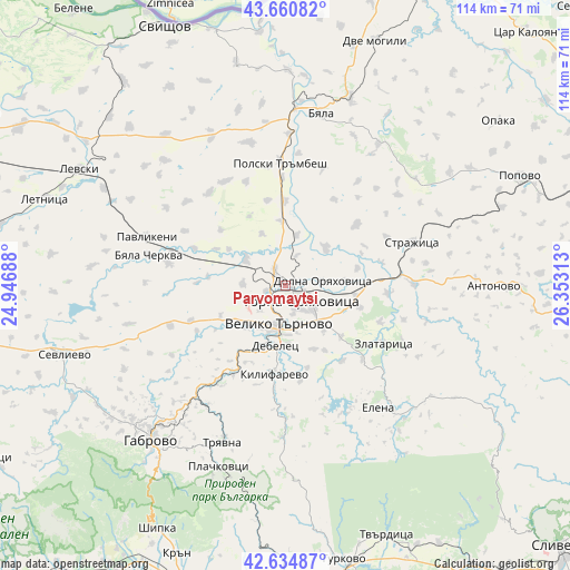
Parvomaytsi GPS coordinates[2]
43° 9' 0" North, 25° 39' 0" East
| Map corner | latitude | longitude |
|---|---|---|
| Upper-left | 43.66082°, | 24.94688° |
| Center: | 43.15°, | 25.65° |
| Lower-right: | 42.63487°, | 26.35313° |
| Map W x H: | 114.1×114.1 km | = 70.9×70.9mi |
| max Lat: | 44.16214° ⇑38% North |
| Parvomaytsi: | 43.15° |
| min Lat: | ⇓62% South 41.32715° |
| min Long | Parvomaytsi | max Long |
| 22.52139° | 25.65° | 28.53429° |
| W 61%⇐ | ⇒39% E |
Elevation
Elevation of Parvomaytsi is 94 m = 308 ft, and this is 222.6 m = 730 ft below average elevation for this country.
| Max E: |
1221 m = 4006 ft | 81.3% |
| Avg. | 316.6 m = 1039 ft | |
| Parvomaytsi | 94 m = 308 ft | |
Min E: |
1 m = 3 ft | 18.7% |
See also: Bulgaria elevation on elevation.city.
Geographical zone
Parvomaytsi is located in North temperate zone (between Tropic of Cancer and the Arctic Circle). Distance of this Northern Tropic circle is 2191.9 km =1362 mi to South.| Distance of | km | miles | from Parvomaytsi |
|---|---|---|---|
| North Pole | 5209.2 | 3236.8 | to North |
| Arctic Circle | 2603.3 | 1617.6 | to North |
| Tropic Cancer | 2191.9 | 1362 | to South |
| Equator | 4797.8 | 2981.2 | to South |


Nearby cities:
15 places around Parvomaytsi: (largest is in red/bold)
• Byala Cherkva
28.9 km =18 mi,  281°
281°
• Debelets
13.3 km =8.3 mi,  191°
191°
• Dryanovo
23.6 km =14.7 mi,  216°
216°
• Elena
30.7 km =19.1 mi,  141°
141°
• Gabrovo
40 km =24.9 mi, 219°
• Gorna Oryahovitsa
4.9 km =3 mi,  120°
120°
• Kilifarevo
18.6 km =11.6 mi,  184°
184°
• Lyaskovets
7.7 km =4.8 mi, 124°
• Pavlikeni
28.5 km =17.7 mi,  291°
291°
• Polski Trambesh
24.7 km =15.3 mi,  357°
357°
• Strazhitsa
27.3 km =17 mi,  70°
70°
• Suhindol
38.3 km =23.8 mi, 276°
• Tryavna
33.8 km =21 mi,  201°
201°
• Veliko Tŭrnovo
7.8 km =4.8 mi, 192°
• Zlataritsa
23.1 km =14.4 mi, 118°
Sources, notices
• [Note1] Compared only with cities in Bulgaria existing in our database
• [Src1] Map data: © OpenStreetMap contributors (CC-BY-SA)
• [Src2] Other city data from geonames.org with taken over terms of usage.
• [Src3] Geographical zone / Annual Mean Temperature by Robert A. Rohde @ Wikipedia
