Debelets geodata
Debelets (Veliko Tarnovo) is a populated place; located in Bulgaria in Europe/Sofia (GMT+3) time zone. With population of 4,418 people, there are 146 cities with bigger population in this country. Compared to other cities in Bulgaria, 57.3% of cities are located further ↓South; 59.3% of cities are located further ←West and 66.7% of cities have higher elevation than Debelets. Note1
Administrative division(s):
- Level 1: Veliko Tarnovo
- Level 2: Obshtina Veliko Tŭrnovo
- Level 3: Debelec


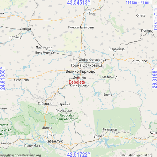
Debelets GPS coordinates[2]
43° 1' 59.988" North, 25° 37' 0.012" East
| Map corner | latitude | longitude |
|---|---|---|
| Upper-left | 43.54513°, | 24.91355° |
| Center: | 43.03333°, | 25.61667° |
| Lower-right: | 42.51722°, | 26.3198° |
| Map W x H: | 114.3×114.3 km | = 71×71mi |
| max Lat: | 44.16214° ⇑42.7% North |
| Debelets: | 43.03333° |
| min Lat: | ⇓57.3% South 41.32715° |
| min Long | Debelets | max Long |
| 22.52139° | 25.61667° | 28.53429° |
| W 59.3%⇐ | ⇒40.7% E |
Elevation
Elevation of Debelets is 158 m = 518 ft, and this is 158.6 m = 520 ft below average elevation for this country.
| Max E: |
1221 m = 4006 ft | 66.7% |
| Avg. | 316.6 m = 1039 ft | |
| Debelets | 158 m = 518 ft | |
Min E: |
1 m = 3 ft | 33.3% |
See also: Bulgaria elevation on elevation.city.
Geographical zone
Debelets is located in North temperate zone (between Tropic of Cancer and the Arctic Circle). Distance of this Northern Tropic circle is 2178.9 km =1353.9 mi to South.| Distance of | km | miles | from Debelets |
|---|---|---|---|
| North Pole | 5222.2 | 3244.9 | to North |
| Arctic Circle | 2616.3 | 1625.7 | to North |
| Tropic Cancer | 2178.9 | 1353.9 | to South |
| Equator | 4784.9 | 2973.2 | to South |


Nearby cities:
15 places around Debelets: (largest is in red/bold)
• Byala Cherkva
31.7 km =19.7 mi,  305°
305°
• Dryanovo
12.8 km =8 mi,  241°
241°
• Elena
24.4 km =15.2 mi,  117°
117°
• Gabrovo
29 km =18 mi,  232°
232°
• Gorna Oryahovitsa
12.6 km =7.8 mi,  33°
33°
• Kilifarevo
5.7 km =3.5 mi,  166°
166°
• Lyaskovets
12.5 km =7.8 mi,  46°
46°
• Parvomaytsi
13.3 km =8.3 mi,  11°
11°
• Pavlikeni
33.4 km =20.8 mi, 314°
• Polski Trambesh
37.7 km =23.4 mi,  2°
2°
• Strazhitsa
36.1 km =22.4 mi, 51°
• Suhindol
39.5 km =24.5 mi,  296°
296°
• Tryavna
20.8 km =12.9 mi,  207°
207°
• Veliko Tŭrnovo
5.4 km =3.4 mi, 10°
• Zlataritsa
23.1 km =14.4 mi,  85°
85°
Sources, notices
• [Note1] Compared only with cities in Bulgaria existing in our database
• [Src1] Map data: © OpenStreetMap contributors (CC-BY-SA)
• [Src2] Other city data from geonames.org with taken over terms of usage.
• [Src3] Geographical zone / Annual Mean Temperature by Robert A. Rohde @ Wikipedia
