Bandar Seri Begawan geodata
Bandar Seri Begawan (Brunei-Muara District) is a capital of a political entity; located in Brunei in Asia/Brunei (GMT+8) time zone. With population of 64,409 people, there are 0 cities with bigger population in this country. Compared to other cities in Brunei, 66.7% of cities are located further ↓South; 50% of cities are located further ←West and 83.3% of cities have lower elevation than Bandar Seri Begawan. Note1


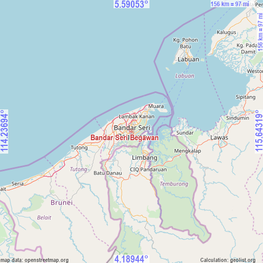
Bandar Seri Begawan GPS coordinates[2]
4° 53' 25.26" North, 114° 56' 24.216" East
| Map corner | latitude | longitude |
|---|---|---|
| Upper-left | 5.59053°, | 114.23694° |
| Center: | 4.89035°, | 114.94006° |
| Lower-right: | 4.18944°, | 115.64319° |
| Map W x H: | 155.8×155.8 km | = 96.8×96.8mi |
| max Lat: | 5.02447° ⇑33.3% North |
| Bandar Seri Begawan: | 4.89035° |
| min Lat: | ⇓66.7% South 4.58361° |
| min Long | Bandar Seri Beg | max Long |
| 114.2312° | 114.94006° | 115.07167° |
| W 50%⇐ | ⇒50% E |
Elevation
Elevation of Bandar Seri Begawan is 10 m = 33 ft, and this is 4.1 m = 13 ft below average elevation for this country.
| Max E: |
75 m = 246 ft | 16.7% |
| Avg. | 14.1 m = 46 ft | |
| Bandar Seri Begawan | 10 m = 33 ft | |
Min E: |
1 m = 3 ft | 83.3% |
See also: Bandar Seri Begawan elevation on elevation.city.
Geographical zone
Bandar Seri Begawan is located in North Torrid zone (between Equator and Tropic of Cancer). Distance of Equator is 543.8 km =337.9 mi to South.| Distance of | km | miles | from Bandar Seri Begawan |
|---|---|---|---|
| North Pole | 9463.3 | 5880.2 | to North |
| Arctic Circle | 6857.4 | 4261 | to North |
| Tropic Cancer | 2062.2 | 1281.4 | to North |
| Equator | 543.8 | 337.9 | to South |


Nearby cities:
6 places around Bandar Seri Begawan: (largest is in red/bold)
• Bangar
24.9 km =15.5 mi,  144°
144°
• Kapok
19 km =11.8 mi,  38°
38°
• Kuala Belait
85.6 km =53.2 mi,  246°
246°
• Mentiri
12.6 km =7.8 mi,  45°
45°
• Seria
75.1 km =46.7 mi, 245°
• Tutong
33.7 km =20.9 mi, 253°
Sources, notices
• [Note1] Compared only with cities in Brunei existing in our database
• [Src1] Map data: © OpenStreetMap contributors (CC-BY-SA)
• [Src2] Other city data from geonames.org with taken over terms of usage.
• [Src3] Geographical zone / Annual Mean Temperature by Robert A. Rohde @ Wikipedia
