Sotomayor geodata
Sotomayor (Chuquisaca) is a seat of a fourth-order administrative division; located in Bolivia in America/La_Paz (GMT-4) time zone. In our database, there are 117 cities with bigger population. Compared to other cities in Bolivia, 77.6% of cities are located further ↑North; 55.9% of cities are located further ←West and 52.8% of cities have higher elevation than Sotomayor. Note1
Administrative division(s):
- Level 1: Chuquisaca
- Level 2: Provincia Yamparáez
- Level 3: Yamparáez
- Level 4: Sotomayor


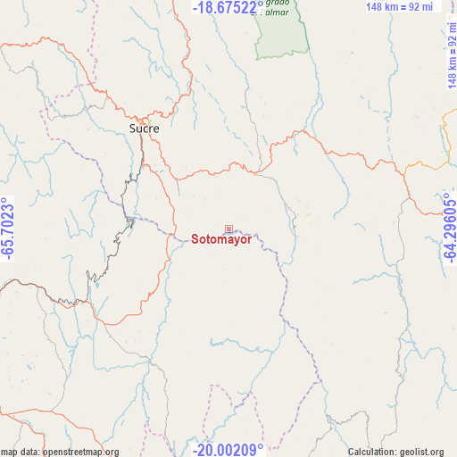
Sotomayor GPS coordinates[2]
19° 20' 24" South, 64° 59' 57.012" West
| Map corner | latitude | longitude |
|---|---|---|
| Upper-left | -18.67522°, | -65.7023° |
| Center: | -19.34°, | -64.99917° |
| Lower-right: | -20.00209°, | -64.29605° |
| Map W x H: | 147.5×147.5 km | = 91.7×91.7mi |
| max Lat: | -9.71828° ⇑77.6% North |
| Sotomayor: | -19.34° |
| min Lat: | ⇓22.4% South -22.73206° |
| min Long | Sotomayor | max Long |
| -69.14843° | -64.99917° | -57.76667° |
| W 55.9%⇐ | ⇒44.1% E |
Elevation
Elevation of Sotomayor is 2184 m = 7165 ft, and this is 172.7 m = 567 ft above average elevation for this country.
| Max E: |
4732 m = 15525 ft | 52.8% |
| Sotomayor | 2184 m 7165 ft | |
| Avg. | 2011.3 m = 6599 ft | |
Min E: |
92 m = 302 ft | 47.2% |
See also: Bolivia elevation on elevation.city.
Geographical zone
Sotomayor is located in South Torrid zone (between Equator and Tropic of Capricorn). Distance of this Southern Tropic circle is 455.5 km =283 mi to South.| Distance of | km | miles | from Sotomayor |
|---|---|---|---|
| Equator | 2150.4 | 1336.2 | to North |
| Tropic Capricorn | 455.5 | 283 | to South |
| Antarctic Circle | 5250.8 | 3262.7 | to South |
| South Pole | 7856.7 | 4881.9 | to South |


Nearby cities:
15 places around Sotomayor: (largest is in red/bold)
• Betanzos
53.2 km =33.1 mi,  243°
243°
• Chaunaca
60.9 km =37.8 mi,  306°
306°
• Chuqui Chuqui
58.6 km =36.4 mi,  353°
353°
• Huata
44.6 km =27.7 mi,  323°
323°
• Huayllas
39.2 km =24.4 mi,  298°
298°
• Maragua
55.7 km =34.6 mi, 305°
• Mojotoro
47.6 km =29.6 mi, 351°
• Presto
46.1 km =28.6 mi,  7°
7°
• Pulqui
25.7 km =16 mi, 297°
• San Pedro
60.7 km =37.7 mi,  120°
120°
• Sucre
43.9 km =27.3 mi, 320°
• Tarabuco
19.7 km =12.2 mi,  26°
26°
• Tomina
51.9 km =32.2 mi,  70°
70°
• Yamparáez
21.2 km =13.2 mi, 322°
• Yotala
34.4 km =21.4 mi, 305°
Sources, notices
• [Note1] Compared only with cities in Bolivia existing in our database
• [Src1] Map data: © OpenStreetMap contributors (CC-BY-SA)
• [Src2] Other city data from geonames.org with taken over terms of usage.
• [Src3] Geographical zone / Annual Mean Temperature by Robert A. Rohde @ Wikipedia
