San Pedro geodata
San Pedro (Chuquisaca) is a seat of a fourth-order administrative division; located in Bolivia in America/La_Paz (GMT-4) time zone. In our database, there are 117 cities with bigger population. Compared to other cities in Bolivia, 79.5% of cities are located further ↑North; 66.5% of cities are located further ←West and 51.6% of cities have higher elevation than San Pedro. Note1
Administrative division(s):
- Level 1: Chuquisaca
- Level 2: Provincia Azurduy
- Level 3: Tarvita (Villa Orías)
- Level 4: San Pedro


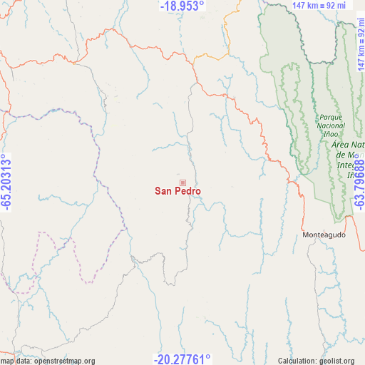
San Pedro GPS coordinates[2]
19° 37' 0.012" South, 64° 30' 0" West
| Map corner | latitude | longitude |
|---|---|---|
| Upper-left | -18.953°, | -65.20313° |
| Center: | -19.61667°, | -64.5° |
| Lower-right: | -20.27761°, | -63.79688° |
| Map W x H: | 147.3×147.3 km | = 91.5×91.5mi |
| max Lat: | -9.71828° ⇑79.5% North |
| San Pedro: | -19.61667° |
| min Lat: | ⇓20.5% South -22.73206° |
| min Long | San Pedro | max Long |
| -69.14843° | -64.5° | -57.76667° |
| W 66.5%⇐ | ⇒33.5% E |
Elevation
Elevation of San Pedro is 2285 m = 7497 ft, and this is 273.7 m = 898 ft above average elevation for this country.
| Max E: |
4732 m = 15525 ft | 51.6% |
| San Pedro | 2285 m 7497 ft | |
| Avg. | 2011.3 m = 6599 ft | |
Min E: |
92 m = 302 ft | 48.4% |
See also: Bolivia elevation on elevation.city.
Geographical zone
San Pedro is located in South Torrid zone (between Equator and Tropic of Capricorn). Distance of this Southern Tropic circle is 424.7 km =263.9 mi to South.| Distance of | km | miles | from San Pedro |
|---|---|---|---|
| Equator | 2181.2 | 1355.3 | to North |
| Tropic Capricorn | 424.7 | 263.9 | to South |
| Antarctic Circle | 5220 | 3243.6 | to South |
| South Pole | 7825.9 | 4862.8 | to South |


Nearby cities:
15 places around San Pedro: (largest is in red/bold)
• Azurduy
55.2 km =34.3 mi,  170°
170°
• Huayllas
99.9 km =62.1 mi,  299°
299°
• Mojocoya
95.6 km =59.4 mi,  352°
352°
• Mojotoro
98 km =60.9 mi,  322°
322°
• Monteagudo
60.6 km =37.7 mi,  109°
109°
• Padilla
40 km =24.9 mi,  31°
31°
• Presto
89.2 km =55.4 mi,  328°
328°
• Pulqui
86.4 km =53.7 mi, 299°
• Sapirangui
82.8 km =51.4 mi,  115°
115°
• Sotomayor
60.7 km =37.7 mi, 300°
• Tarabuco
65.1 km =40.5 mi, 318°
• Tomina
48.3 km =30 mi,  355°
355°
• Villa Serrano
57.7 km =35.9 mi,  18°
18°
• Yamparáez
80.8 km =50.2 mi,  306°
306°
• Yotala
95 km =59 mi, 302°
Sources, notices
• [Note1] Compared only with cities in Bolivia existing in our database
• [Src1] Map data: © OpenStreetMap contributors (CC-BY-SA)
• [Src2] Other city data from geonames.org with taken over terms of usage.
• [Src3] Geographical zone / Annual Mean Temperature by Robert A. Rohde @ Wikipedia
