San Julian geodata
San Julian (Santa Cruz) is a populated place; located in Bolivia in America/La_Paz (GMT-4) time zone. With population of 7,706 people, there are 51 cities with bigger population in this country. Compared to other cities in Bolivia, 53.4% of cities are located further ↓South; 93.2% of cities are located further ←West and 80.1% of cities have higher elevation than San Julian. Note1


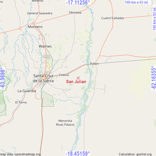
San Julian GPS coordinates[2]
17° 46' 59.988" South, 62° 52' 0.012" West
| Map corner | latitude | longitude |
|---|---|---|
| Upper-left | -17.11256°, | -63.5698° |
| Center: | -17.78333°, | -62.86667° |
| Lower-right: | -18.45159°, | -62.16355° |
| Map W x H: | 148.9×148.9 km | = 92.5×92.5mi |
| max Lat: | -9.71828° ⇑46.6% North |
| San Julian: | -17.78333° |
| min Lat: | ⇓53.4% South -22.73206° |
| min Long | San Julian | max Long |
| -69.14843° | -62.86667° | -57.76667° |
| W 93.2%⇐ | ⇒6.8% E |
Elevation
Elevation of San Julian is 332 m = 1089 ft, and this is 1679.3 m = 5510 ft below average elevation for this country.
| Max E: |
4732 m = 15525 ft | 80.1% |
| Avg. | 2011.3 m = 6599 ft | |
| San Julian | 332 m = 1089 ft | |
Min E: |
92 m = 302 ft | 19.9% |
See also: Bolivia elevation on elevation.city.
Geographical zone
San Julian is located in South Torrid zone (between Equator and Tropic of Capricorn). Distance of this Southern Tropic circle is 628.6 km =390.6 mi to South.| Distance of | km | miles | from San Julian |
|---|---|---|---|
| Equator | 1977.3 | 1228.6 | to North |
| Tropic Capricorn | 628.6 | 390.6 | to South |
| Antarctic Circle | 5423.9 | 3370.3 | to South |
| South Pole | 8029.7 | 4989.4 | to South |


Nearby cities:
15 places around San Julian: (largest is in red/bold)
• Cotoca
5.1 km =3.2 mi,  42°
42°
• Cotoca
19.8 km =12.3 mi,  259°
259°
• La Bélgica
45.3 km =28.1 mi,  304°
304°
• Los Negros
60.3 km =37.5 mi,  275°
275°
• Okinawa Número Uno
61.4 km =38.2 mi,  4°
4°
• Pailón
19.3 km =12 mi, 39°
• Paurito
15.4 km =9.6 mi,  223°
223°
• Puearto Pailas
14.6 km =9.1 mi,  23°
23°
• Puesto de Pailas
16.4 km =10.2 mi,  25°
25°
• San Julian
4 km =2.5 mi,  230°
230°
• Santa Cruz de la Sierra
33.3 km =20.7 mi,  269°
269°
• Santa Fe
23 km =14.3 mi, 232°
• Santa Rita
55.1 km =34.2 mi,  248°
248°
• Santiago del Torno
59 km =36.7 mi, 247°
• Warnes
43.6 km =27.1 mi,  312°
312°
Sources, notices
• [Note1] Compared only with cities in Bolivia existing in our database
• [Src1] Map data: © OpenStreetMap contributors (CC-BY-SA)
• [Src2] Other city data from geonames.org with taken over terms of usage.
• [Src3] Geographical zone / Annual Mean Temperature by Robert A. Rohde @ Wikipedia
