Cotoca geodata
Cotoca (Santa Cruz) is a populated place; located in Bolivia in America/La_Paz (GMT-4) time zone. With population of 18,347 people, there are 28 cities with bigger population in this country. Compared to other cities in Bolivia, 51.6% of cities are located further ↓South; 90.1% of cities are located further ←West and 75.2% of cities have higher elevation than Cotoca. Note1


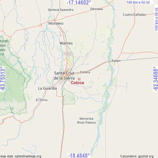
Cotoca GPS coordinates[2]
17° 49' 0.012" South, 63° 3' 0" West
| Map corner | latitude | longitude |
|---|---|---|
| Upper-left | -17.14602°, | -63.75313° |
| Center: | -17.81667°, | -63.05° |
| Lower-right: | -18.4848°, | -62.34688° |
| Map W x H: | 148.9×148.9 km | = 92.5×92.5mi |
| max Lat: | -9.71828° ⇑48.4% North |
| Cotoca: | -17.81667° |
| min Lat: | ⇓51.6% South -22.73206° |
| min Long | Cotoca | max Long |
| -69.14843° | -63.05° | -57.76667° |
| W 90.1%⇐ | ⇒9.9% E |
Elevation
Elevation of Cotoca is 387 m = 1270 ft, and this is 1624.3 m = 5329 ft below average elevation for this country.
| Max E: |
4732 m = 15525 ft | 75.2% |
| Avg. | 2011.3 m = 6599 ft | |
| Cotoca | 387 m = 1270 ft | |
Min E: |
92 m = 302 ft | 24.8% |
See also: Bolivia elevation on elevation.city.
Geographical zone
Cotoca is located in South Torrid zone (between Equator and Tropic of Capricorn). Distance of this Southern Tropic circle is 624.9 km =388.3 mi to South.| Distance of | km | miles | from Cotoca |
|---|---|---|---|
| Equator | 1981 | 1230.9 | to North |
| Tropic Capricorn | 624.9 | 388.3 | to South |
| Antarctic Circle | 5420.1 | 3367.9 | to South |
| South Pole | 8026 | 4987.1 | to South |


Nearby cities:
15 places around Cotoca: (largest is in red/bold)
• Cotoca
24 km =14.9 mi,  71°
71°
• La Bélgica
34.5 km =21.4 mi,  329°
329°
• Limoncito
44.5 km =27.7 mi,  237°
237°
• Los Negros
41.6 km =25.8 mi,  282°
282°
• Pailón
36.8 km =22.9 mi,  59°
59°
• Paurito
11.5 km =7.1 mi,  130°
130°
• Puearto Pailas
30.4 km =18.9 mi, 55°
• Puesto de Pailas
32.3 km =20.1 mi, 55°
• San Julian
16.4 km =10.2 mi,  85°
85°
• San Julian
19.8 km =12.3 mi,  79°
79°
• Santa Cruz de la Sierra
14.3 km =8.9 mi, 283°
• Santa Fe
10.2 km =6.3 mi,  173°
173°
• Santa Rita
35.9 km =22.3 mi, 242°
• Santiago del Torno
39.8 km =24.7 mi, 241°
• Warnes
35.7 km =22.2 mi,  339°
339°
Sources, notices
• [Note1] Compared only with cities in Bolivia existing in our database
• [Src1] Map data: © OpenStreetMap contributors (CC-BY-SA)
• [Src2] Other city data from geonames.org with taken over terms of usage.
• [Src3] Geographical zone / Annual Mean Temperature by Robert A. Rohde @ Wikipedia
