Pocpo geodata
Pocpo (Chuquisaca) is a seat of a fourth-order administrative division; located in Bolivia in America/La_Paz (GMT-4) time zone. In our database, there are 117 cities with bigger population. Compared to other cities in Bolivia, 65.8% of cities are located further ↑North; 56.5% of cities are located further →East and 72% of cities have lower elevation than Pocpo. Note1
Administrative division(s):
- Level 1: Chuquisaca
- Level 2: Provincia Oropeza
- Level 3: Poroma
- Level 4: Pocpo


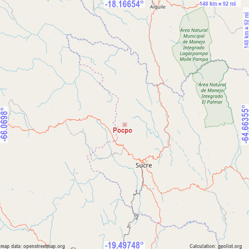
Pocpo GPS coordinates[2]
18° 49' 59.988" South, 65° 22' 0.012" West
| Map corner | latitude | longitude |
|---|---|---|
| Upper-left | -18.16654°, | -66.0698° |
| Center: | -18.83333°, | -65.36667° |
| Lower-right: | -19.49748°, | -64.66355° |
| Map W x H: | 148×148 km | = 92×92mi |
| max Lat: | -9.71828° ⇑65.8% North |
| Pocpo: | -18.83333° |
| min Lat: | ⇓34.2% South -22.73206° |
| min Long | Pocpo | max Long |
| -69.14843° | -65.36667° | -57.76667° |
| W 43.5%⇐ | ⇒56.5% E |
Elevation
Elevation of Pocpo is 3050 m = 10007 ft, and this is 1038.7 m = 3408 ft above average elevation for this country.
| Max E: |
4732 m = 15525 ft | 28% |
| Pocpo | 3050 m 10007 ft | |
| Avg. | 2011.3 m = 6599 ft | |
Min E: |
92 m = 302 ft | 72% |
See also: Bolivia elevation on elevation.city.
Geographical zone
Pocpo is located in South Torrid zone (between Equator and Tropic of Capricorn). Distance of this Southern Tropic circle is 511.8 km =318 mi to South.| Distance of | km | miles | from Pocpo |
|---|---|---|---|
| Equator | 2094.1 | 1301.2 | to North |
| Tropic Capricorn | 511.8 | 318 | to South |
| Antarctic Circle | 5307.1 | 3297.7 | to South |
| South Pole | 7913 | 4916.9 | to South |


Nearby cities:
15 places around Pocpo: (largest is in red/bold)
• Chaunaca
22.9 km =14.2 mi,  207°
207°
• Chuqui Chuqui
31.6 km =19.6 mi,  86°
86°
• Huata
23.8 km =14.8 mi,  148°
148°
• Huayllas
37.6 km =23.4 mi,  173°
173°
• Maragua
24.5 km =15.2 mi,  195°
195°
• Mojotoro
32.9 km =20.4 mi,  106°
106°
• Piocera
9.9 km =6.2 mi,  339°
339°
• Potolo
25.6 km =15.9 mi,  221°
221°
• Presto
46.2 km =28.7 mi,  103°
103°
• Pulqui
47.2 km =29.3 mi,  160°
160°
• Sotomayor
68.3 km =42.4 mi, 145°
• Sucre
24.8 km =15.4 mi, 153°
• Tarabuco
61.3 km =38.1 mi,  129°
129°
• Yamparáez
47.1 km =29.3 mi, 147°
• Yotala
37.7 km =23.4 mi, 163°
Sources, notices
• [Note1] Compared only with cities in Bolivia existing in our database
• [Src1] Map data: © OpenStreetMap contributors (CC-BY-SA)
• [Src2] Other city data from geonames.org with taken over terms of usage.
• [Src3] Geographical zone / Annual Mean Temperature by Robert A. Rohde @ Wikipedia
