Tomé Açu geodata
Tomé Açu (Pará) is a populated place; located in Brazil in America/Belem (GMT-3) time zone. With population of 34,053 people, there are 606 cities with bigger population in this country. Compared to other cities in Brazil, 96.9% of cities are located further ↓South; 65.3% of cities are located further →East and 88.3% of cities have higher elevation than Tomé Açu. Note1


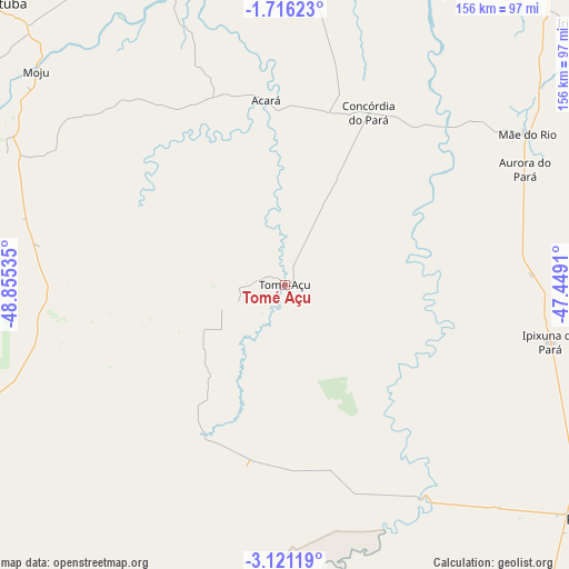
Tomé Açu GPS coordinates[2]
2° 25' 8.004" South, 48° 9' 7.992" West
| Map corner | latitude | longitude |
|---|---|---|
| Upper-left | -1.71623°, | -48.85535° |
| Center: | -2.41889°, | -48.15222° |
| Lower-right: | -3.12119°, | -47.4491° |
| Map W x H: | 156.2×156.2 km | = 97.1×97.1mi |
| max Lat: | 2.81972° ⇑3.1% North |
| Tomé Açu: | -2.41889° |
| min Lat: | ⇓96.9% South -33.69111° |
| min Long | Tomé Açu | max Long |
| -72.89583° | -48.15222° | -32.41083° |
| W 34.7%⇐ | ⇒65.3% E |
Elevation
Elevation of Tomé Açu is 21 m = 69 ft, and this is 359.9 m = 1181 ft below average elevation for this country.
| Max E: |
1603 m = 5259 ft | 88.3% |
| Avg. | 380.9 m = 1250 ft | |
| Tomé Açu | 21 m = 69 ft | |
Min E: |
0 m = 0 ft | 11.7% |
See also: Brazil elevation on elevation.city.
Geographical zone
Tomé Açu is located in South Torrid zone (between Equator and Tropic of Capricorn). Distance of Equator is 269 km =167.1 mi to North.| Distance of | km | miles | from Tomé Açu |
|---|---|---|---|
| Equator | 269 | 167.1 | to North |
| Tropic Capricorn | 2337 | 1452.1 | to South |
| Antarctic Circle | 7132.2 | 4431.7 | to South |
| South Pole | 9738.1 | 6051 | to South |


Nearby cities:
15 places around Tomé Açu: (largest is in red/bold)
• Abaetetuba
112.5 km =69.9 mi,  313°
313°
• Acará
51.2 km =31.8 mi,  354°
354°
• Ananindeua
119.6 km =74.3 mi, 348°
• Barcarena
114.4 km =71.1 mi,  332°
332°
• Belém
114 km =70.8 mi,  339°
339°
• Benevides
118 km =73.3 mi,  355°
355°
• Bujaru
101.2 km =62.9 mi,  6°
6°
• Castanhal
127.6 km =79.3 mi, 11°
• Igarapé Miri
102.4 km =63.6 mi,  298°
298°
• Irituia
107.2 km =66.6 mi,  47°
47°
• Moju
90.7 km =56.4 mi, 310°
• Paragominas
96.1 km =59.7 mi,  129°
129°
• Santa Maria do Pará
135 km =83.9 mi,  28°
28°
• Santo Antônio do Tauá
140.9 km =87.6 mi,  1°
1°
• São Miguel do Guamá
115.3 km =71.6 mi,  40°
40°
Sources, notices
• [Note1] Compared only with cities in Brazil existing in our database
• [Src1] Map data: © OpenStreetMap contributors (CC-BY-SA)
• [Src2] Other city data from geonames.org with taken over terms of usage.
• [Src3] Geographical zone / Annual Mean Temperature by Robert A. Rohde @ Wikipedia
