Tianguá geodata
Tianguá (Ceará) is a populated place; located in Brazil in America/Fortaleza (GMT-3) time zone. With population of 45,696 people, there are 467 cities with bigger population in this country. Compared to other cities in Brazil, 92.5% of cities are located further ↓South; 70.2% of cities are located further ←West and 86.9% of cities have lower elevation than Tianguá. Note1


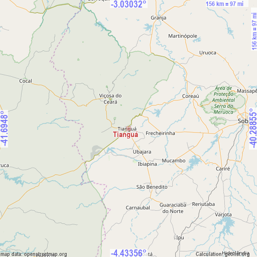
Tianguá GPS coordinates[2]
3° 43' 55.992" South, 40° 59' 30.012" West
| Map corner | latitude | longitude |
|---|---|---|
| Upper-left | -3.03032°, | -41.6948° |
| Center: | -3.73222°, | -40.99167° |
| Lower-right: | -4.43356°, | -40.28855° |
| Map W x H: | 156×156 km | = 96.9×96.9mi |
| max Lat: | 2.81972° ⇑7.5% North |
| Tianguá: | -3.73222° |
| min Lat: | ⇓92.5% South -33.69111° |
| min Long | Tianguá | max Long |
| -72.89583° | -40.99167° | -32.41083° |
| W 70.2%⇐ | ⇒29.8% E |
Elevation
Elevation of Tianguá is 773 m = 2536 ft, and this is 392.1 m = 1286 ft above average elevation for this country.
| Max E: |
1603 m = 5259 ft | 13.1% |
| Tianguá | 773 m 2536 ft | |
| Avg. | 380.9 m = 1250 ft | |
Min E: |
0 m = 0 ft | 86.9% |
See also: Tianguá elevation on elevation.city.
Geographical zone
Tianguá is located in South Torrid zone (between Equator and Tropic of Capricorn). Distance of Equator is 415 km =257.9 mi to North.| Distance of | km | miles | from Tianguá |
|---|---|---|---|
| Equator | 415 | 257.9 | to North |
| Tropic Capricorn | 2190.9 | 1361.4 | to South |
| Antarctic Circle | 6986.2 | 4341 | to South |
| South Pole | 9592.1 | 5960.3 | to South |


Nearby cities:
15 places around Tianguá: (largest is in red/bold)
• Barroquinha
80.9 km =50.3 mi,  348°
348°
• Cariré
62.4 km =38.8 mi,  112°
112°
• Cocal
69.1 km =42.9 mi,  294°
294°
• Coreaú
43.3 km =26.9 mi,  59°
59°
• Forquilha
81.4 km =50.6 mi,  95°
95°
• Granja
70.5 km =43.8 mi,  15°
15°
• Guaraciaba do Norte
55.4 km =34.4 mi,  150°
150°
• Ibiapina
24.1 km =15 mi, 151°
• Ipu
72.6 km =45.1 mi, 154°
• Juá dos Vieiras
40.7 km =25.3 mi,  302°
302°
• Reriutaba
64.3 km =40 mi,  135°
135°
• Sobral
71.4 km =44.4 mi,  85°
85°
• Ubajara
15.7 km =9.8 mi, 150°
• Varjota
76.8 km =47.7 mi,  131°
131°
• Viçosa do Ceará
21.9 km =13.6 mi,  329°
329°
Sources, notices
• [Note1] Compared only with cities in Brazil existing in our database
• [Src1] Map data: © OpenStreetMap contributors (CC-BY-SA)
• [Src2] Other city data from geonames.org with taken over terms of usage.
• [Src3] Geographical zone / Annual Mean Temperature by Robert A. Rohde @ Wikipedia
