São Gonçalo do Amarante geodata
São Gonçalo do Amarante (Ceará) is a populated place; located in Brazil in America/Fortaleza (GMT-3) time zone. With population of 23,583 people, there are 816 cities with bigger population in this country. Compared to other cities in Brazil, 93.1% of cities are located further ↓South; 80.4% of cities are located further ←West and 87.3% of cities have higher elevation than São Gonçalo do Amarante. Note1
Current local time in São Gonçalo do Amarante:
05:47 AM, SaturdayDifference from your time zone: hours


São Gonçalo do Amarante GPS coordinates[2]
3° 36' 25.992" South, 38° 58' 5.988" West
| Map corner | latitude | longitude |
|---|---|---|
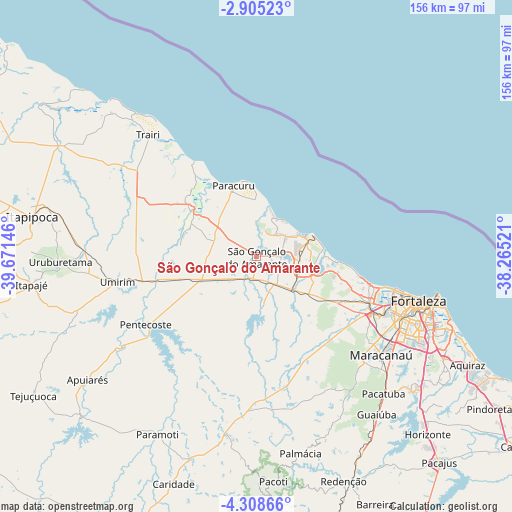
| Upper-left | -2.90523°, | -39.67146° |
| Center: | -3.60722°, | -38.96833° |
| Lower-right: | -4.30866°, | -38.26521° |
| Map W x H: | 156×156.1 km | = 96.9×97mi |
| max Lat: | 2.81972° ⇑6.9% North |
| São Gonçalo do Amarante: | -3.60722° |
| min Lat: | ⇓93.1% South -33.69111° |
| min Long | São Gonçalo d | max Long |
| -72.89583° | -38.96833° | -32.41083° |
| W 80.4%⇐ | ⇒19.6% E |
Elevation
Elevation of São Gonçalo do Amarante is 23 m = 75 ft, and this is 357.9 m = 1174 ft below average elevation for this country.
| Max E: |
1603 m = 5259 ft | 87.3% |
| Avg. | 380.9 m = 1250 ft | |
| São Gonçalo do Amarante | 23 m = 75 ft | |
Min E: |
0 m = 0 ft | 12.7% |
See also: Brazil elevation on elevation.city.
Geographical zone
São Gonçalo do Amarante is located in South Torrid zone (between Equator and Tropic of Capricorn). Distance of Equator is 401.1 km =249.2 mi to North.| Distance of | km | miles | from São Gonçalo do Amarante |
|---|---|---|---|
| Equator | 401.1 | 249.2 | to North |
| Tropic Capricorn | 2204.8 | 1370 | to South |
| Antarctic Circle | 7000.1 | 4349.7 | to South |
| South Pole | 9606 | 5968.9 | to South |


Nearby cities:
15 places around São Gonçalo do Amarante: (largest is in red/bold)
• Cambebba
15.5 km =9.6 mi,  95°
95°
• Caucaia
37.8 km =23.5 mi,  112°
112°
• Eusébio
65.5 km =40.7 mi,  118°
118°
• Fortaleza
48.7 km =30.3 mi, 104°
• Guaiúba
60.5 km =37.6 mi,  142°
142°
• Itaitinga
63.3 km =39.3 mi,  129°
129°
• Jardim
18.7 km =11.6 mi,  328°
328°
• Maracanaú
48.4 km =30.1 mi, 128°
• Pacatuba
57 km =35.4 mi, 137°
• Paracuru
23 km =14.3 mi,  342°
342°
• Paraipaba
27.3 km =17 mi,  313°
313°
• Pentecoste
39.3 km =24.4 mi,  238°
238°
• Trairi
49.5 km =30.8 mi,  317°
317°
• Umirim
43.1 km =26.8 mi,  259°
259°
• Uruburetama
60 km =37.3 mi,  268°
268°
Sources, notices
• [Note1] Compared only with cities in Brazil existing in our database
• [Src1] Map data: © OpenStreetMap contributors (CC-BY-SA)
• [Src2] Other city data from geonames.org with taken over terms of usage.
• [Src3] Geographical zone / Annual Mean Temperature by Robert A. Rohde @ Wikipedia
