Pentecoste geodata
Pentecoste (Ceará) is a populated place; located in Brazil in America/Fortaleza (GMT-3) time zone. With population of 19,680 people, there are 952 cities with bigger population in this country. Compared to other cities in Brazil, 92.2% of cities are located further ↓South; 78.8% of cities are located further ←West and 77.6% of cities have higher elevation than Pentecoste. Note1


Pentecoste GPS coordinates[2]
3° 47' 34.008" South, 39° 16' 13.008" West
| Map corner | latitude | longitude |
|---|---|---|
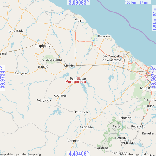
| Upper-left | -3.09093°, | -39.97341° |
| Center: | -3.79278°, | -39.27028° |
| Lower-right: | -4.49406°, | -38.56716° |
| Map W x H: | 156×156 km | = 96.9×96.9mi |
| max Lat: | 2.81972° ⇑7.8% North |
| Pentecoste: | -3.79278° |
| min Lat: | ⇓92.2% South -33.69111° |
| min Long | Pentecoste | max Long |
| -72.89583° | -39.27028° | -32.41083° |
| W 78.8%⇐ | ⇒21.2% E |
Elevation
Elevation of Pentecoste is 59 m = 194 ft, and this is 321.9 m = 1056 ft below average elevation for this country.
| Max E: |
1603 m = 5259 ft | 77.6% |
| Avg. | 380.9 m = 1250 ft | |
| Pentecoste | 59 m = 194 ft | |
Min E: |
0 m = 0 ft | 22.4% |
See also: Brazil elevation on elevation.city.
Geographical zone
Pentecoste is located in South Torrid zone (between Equator and Tropic of Capricorn). Distance of Equator is 421.7 km =262 mi to North.| Distance of | km | miles | from Pentecoste |
|---|---|---|---|
| Equator | 421.7 | 262 | to North |
| Tropic Capricorn | 2184.2 | 1357.2 | to South |
| Antarctic Circle | 6979.5 | 4336.9 | to South |
| South Pole | 9585.3 | 5956 | to South |


Nearby cities:
15 places around Pentecoste: (largest is in red/bold)
• Baturité
73.3 km =45.5 mi,  144°
144°
• Cambebba
52.5 km =32.6 mi,  68°
68°
• Canindé
63.1 km =39.2 mi,  184°
184°
• Caucaia
68.8 km =42.8 mi,  84°
84°
• Irauçuba
57.2 km =35.5 mi,  275°
275°
• Itapagé
37 km =23 mi,  288°
288°
• Itapipoca
47.7 km =29.6 mi,  314°
314°
• Jardim
43.5 km =27 mi,  32°
32°
• Maracanaú
72.1 km =44.8 mi,  97°
97°
• Paracuru
50.2 km =31.2 mi, 32°
• Paraipaba
41.6 km =25.8 mi,  19°
19°
• São Gonçalo do Amarante
39.3 km =24.4 mi,  58°
58°
• Trairi
57.3 km =35.6 mi,  0°
0°
• Umirim
15.6 km =9.7 mi,  325°
325°
• Uruburetama
32.3 km =20.1 mi, 305°
Sources, notices
• [Note1] Compared only with cities in Brazil existing in our database
• [Src1] Map data: © OpenStreetMap contributors (CC-BY-SA)
• [Src2] Other city data from geonames.org with taken over terms of usage.
• [Src3] Geographical zone / Annual Mean Temperature by Robert A. Rohde @ Wikipedia
