Jaboatão geodata
Jaboatão (Pernambuco) is a populated locality; located in Brazil in America/Recife (GMT-3) time zone. With population of 702,621 people, there are 22 cities with bigger population in this country. Compared to other cities in Brazil, 74.2% of cities are located further ↓South; 99.2% of cities are located further ←West and 74% of cities have higher elevation than Jaboatão. Note1


Jaboatão GPS coordinates[2]
8° 10' 49.008" South, 35° 0' 5.004" West
| Map corner | latitude | longitude |
|---|---|---|
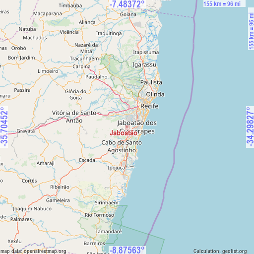
| Upper-left | -7.48372°, | -35.70452° |
| Center: | -8.18028°, | -35.00139° |
| Lower-right: | -8.87563°, | -34.29827° |
| Map W x H: | 154.8×154.8 km | = 96.2×96.2mi |
| max Lat: | 2.81972° ⇑25.8% North |
| Jaboatão: | -8.18028° |
| min Lat: | ⇓74.2% South -33.69111° |
| min Long | Jaboatão | max Long |
| -72.89583° | -35.00139° | -32.41083° |
| W 99.2%⇐ | ⇒0.8% E |
Elevation
Elevation of Jaboatão is 88 m = 289 ft, and this is 292.9 m = 961 ft below average elevation for this country.
| Max E: |
1603 m = 5259 ft | 74% |
| Avg. | 380.9 m = 1250 ft | |
| Jaboatão | 88 m = 289 ft | |
Min E: |
0 m = 0 ft | 26% |
See also: Jaboatão elevation on elevation.city.
Geographical zone
Jaboatão is located in South Torrid zone (between Equator and Tropic of Capricorn). Distance of Equator is 909.6 km =565.2 mi to North.| Distance of | km | miles | from Jaboatão |
|---|---|---|---|
| Equator | 909.6 | 565.2 | to North |
| Tropic Capricorn | 1696.4 | 1054.1 | to South |
| Antarctic Circle | 6491.6 | 4033.7 | to South |
| South Pole | 9097.5 | 5652.9 | to South |


Nearby cities:
15 places around Jaboatão: (largest is in red/bold)
• Abreu e Lima
31.8 km =19.8 mi,  19°
19°
• Cabo
12 km =7.5 mi,  197°
197°
• Escada
31.5 km =19.6 mi,  230°
230°
• Glória do Goitá
37.7 km =23.4 mi,  301°
301°
• Igarassu
39.9 km =24.8 mi, 15°
• Ipojuca
25.3 km =15.7 mi, 195°
• Jaboatão dos Guararapes
7.6 km =4.7 mi,  348°
348°
• Lagoa do Itaenga
41.8 km =26 mi,  310°
310°
• Moreno
12.1 km =7.5 mi, 304°
• Olinda
24.9 km =15.5 mi,  40°
40°
• Paulista
30.1 km =18.7 mi,  27°
27°
• Pombos
43.6 km =27.1 mi,  275°
275°
• Recife
19.3 km =12 mi, 43°
• São Lourenço da Mata
19.9 km =12.4 mi, 354°
• Vitória de Santo Antão
32.7 km =20.3 mi, 282°
Sources, notices
• [Note1] Compared only with cities in Brazil existing in our database
• [Src1] Map data: © OpenStreetMap contributors (CC-BY-SA)
• [Src2] Other city data from geonames.org with taken over terms of usage.
• [Src3] Geographical zone / Annual Mean Temperature by Robert A. Rohde @ Wikipedia
