Olinda geodata
Olinda (Pernambuco) is a populated place; located in Brazil in America/Recife (GMT-3) time zone. With population of 366,754 people, there are 54 cities with bigger population in this country. Compared to other cities in Brazil, 74.9% of cities are located further ↓South; 99.8% of cities are located further ←West and 82.5% of cities have higher elevation than Olinda. Note1


Olinda GPS coordinates[2]
8° 0' 32.004" South, 34° 51' 19.008" West
| Map corner | latitude | longitude |
|---|---|---|
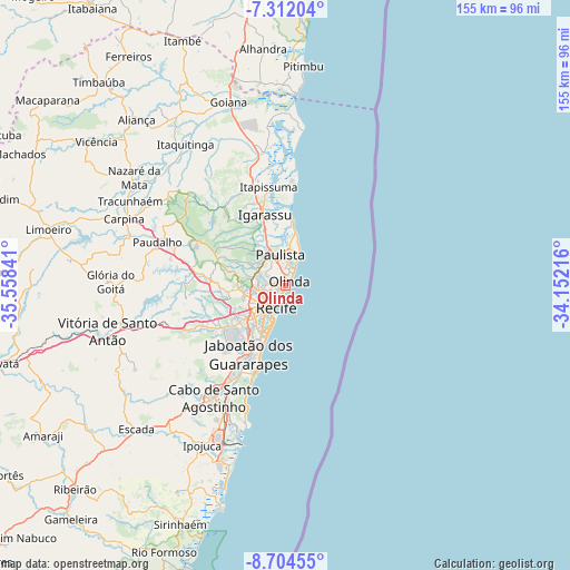
| Upper-left | -7.31204°, | -35.55841° |
| Center: | -8.00889°, | -34.85528° |
| Lower-right: | -8.70455°, | -34.15216° |
| Map W x H: | 154.8×154.8 km | = 96.2×96.2mi |
| max Lat: | 2.81972° ⇑25.1% North |
| Olinda: | -8.00889° |
| min Lat: | ⇓74.9% South -33.69111° |
| min Long | Olinda | max Long |
| -72.89583° | -34.85528° | -32.41083° |
| W 99.8%⇐ | ⇒0.2% E |
Elevation
Elevation of Olinda is 37 m = 121 ft, and this is 343.9 m = 1128 ft below average elevation for this country.
| Max E: |
1603 m = 5259 ft | 82.5% |
| Avg. | 380.9 m = 1250 ft | |
| Olinda | 37 m = 121 ft | |
Min E: |
0 m = 0 ft | 17.5% |
See also: Olinda elevation on elevation.city.
Geographical zone
Olinda is located in South Torrid zone (between Equator and Tropic of Capricorn). Distance of Equator is 890.5 km =553.3 mi to North.| Distance of | km | miles | from Olinda |
|---|---|---|---|
| Equator | 890.5 | 553.3 | to North |
| Tropic Capricorn | 1715.4 | 1065.9 | to South |
| Antarctic Circle | 6510.7 | 4045.6 | to South |
| South Pole | 9116.6 | 5664.8 | to South |


Nearby cities:
15 places around Olinda: (largest is in red/bold)
• Abreu e Lima
12 km =7.5 mi,  334°
334°
• Araçoiaba
35.6 km =22.1 mi,  313°
313°
• Cabo
36.3 km =22.6 mi,  212°
212°
• Carpina
47.4 km =29.5 mi,  291°
291°
• Glória do Goitá
48.2 km =30 mi,  270°
270°
• Igarassu
20.2 km =12.6 mi,  343°
343°
• Itamaracá
29.2 km =18.1 mi,  6°
6°
• Itapissuma
26.2 km =16.3 mi,  351°
351°
• Itaquitinga
46.6 km =29 mi,  324°
324°
• Jaboatão
24.9 km =15.5 mi,  220°
220°
• Jaboatão dos Guararapes
21 km =13 mi,  236°
236°
• Moreno
28.8 km =17.9 mi, 244°
• Paulista
7.8 km =4.8 mi, 345°
• Recife
5.8 km =3.6 mi, 209°
• São Lourenço da Mata
18 km =11.2 mi, 272°
Sources, notices
• [Note1] Compared only with cities in Brazil existing in our database
• [Src1] Map data: © OpenStreetMap contributors (CC-BY-SA)
• [Src2] Other city data from geonames.org with taken over terms of usage.
• [Src3] Geographical zone / Annual Mean Temperature by Robert A. Rohde @ Wikipedia
