Bom Jesus geodata
Bom Jesus (Piauí) is a populated place; located in Brazil in America/Fortaleza (GMT-3) time zone. With population of 12,666 people, there are 1401 cities with bigger population in this country. Compared to other cities in Brazil, 70.9% of cities are located further ↓South; 54% of cities are located further ←West and 54.3% of cities have higher elevation than Bom Jesus. Note1


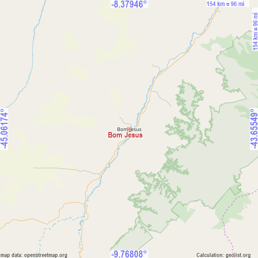
Bom Jesus GPS coordinates[2]
9° 4' 27.984" South, 44° 21' 30.996" West
| Map corner | latitude | longitude |
|---|---|---|
| Upper-left | -8.37946°, | -45.06174° |
| Center: | -9.07444°, | -44.35861° |
| Lower-right: | -9.76808°, | -43.65549° |
| Map W x H: | 154.4×154.4 km | = 95.9×95.9mi |
| max Lat: | 2.81972° ⇑29.1% North |
| Bom Jesus: | -9.07444° |
| min Lat: | ⇓70.9% South -33.69111° |
| min Long | Bom Jesus | max Long |
| -72.89583° | -44.35861° | -32.41083° |
| W 54%⇐ | ⇒46% E |
Elevation
Elevation of Bom Jesus is 281 m = 922 ft, and this is 99.9 m = 328 ft below average elevation for this country.
| Max E: |
1603 m = 5259 ft | 54.3% |
| Avg. | 380.9 m = 1250 ft | |
| Bom Jesus | 281 m = 922 ft | |
Min E: |
0 m = 0 ft | 45.7% |
See also: Brazil elevation on elevation.city.
Geographical zone
Bom Jesus is located in South Torrid zone (between Equator and Tropic of Capricorn). Distance of Equator is 1009 km =627 mi to North.| Distance of | km | miles | from Bom Jesus |
|---|---|---|---|
| Equator | 1009 | 627 | to North |
| Tropic Capricorn | 1596.9 | 992.3 | to South |
| Antarctic Circle | 6392.2 | 3971.9 | to South |
| South Pole | 8998.1 | 5591.2 | to South |


Nearby cities:
15 places around Bom Jesus: (largest is in red/bold)
• Balsas
251.9 km =156.5 mi,  312°
312°
• Barra
260.7 km =162 mi,  149°
149°
• Canto do Buriti
188.9 km =117.4 mi,  55°
55°
• Formosa do Rio Preto
237.7 km =147.7 mi,  202°
202°
• Gilbués
137 km =85.1 mi,  232°
232°
• Itaueira
219.7 km =136.5 mi,  41°
41°
• Morros
217.1 km =134.9 mi,  259°
259°
• Pastos Bons
276.7 km =171.9 mi,  6°
6°
• Raposa
285.1 km =177.2 mi,  3°
3°
• São João do Piauí
245.4 km =152.5 mi,  71°
71°
• São João dos Patos
295.8 km =183.8 mi, 14°
• São Raimundo Nonato
182.3 km =113.3 mi,  87°
87°
• São Raimundo das Mangabeiras
259.5 km =161.2 mi,  331°
331°
• Uruçuí
206.3 km =128.2 mi,  353°
353°
• Xique Xique
264 km =164 mi,  137°
137°
Sources, notices
• [Note1] Compared only with cities in Brazil existing in our database
• [Src1] Map data: © OpenStreetMap contributors (CC-BY-SA)
• [Src2] Other city data from geonames.org with taken over terms of usage.
• [Src3] Geographical zone / Annual Mean Temperature by Robert A. Rohde @ Wikipedia
