Três Coroas geodata
Três Coroas (Rio Grande do Sul) is a populated place; located in Brazil in America/Sao_Paulo (GMT-3) time zone. With population of 21,051 people, there are 903 cities with bigger population in this country. Compared to other cities in Brazil, 96.9% of cities are located further ↑North; 81.4% of cities are located further →East and 78.9% of cities have higher elevation than Três Coroas. Note1


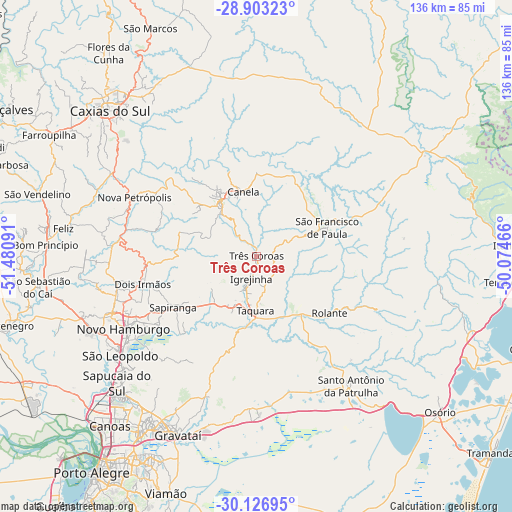
Três Coroas GPS coordinates[2]
29° 31' 0.984" South, 50° 46' 40.008" West
| Map corner | latitude | longitude |
|---|---|---|
| Upper-left | -28.90323°, | -51.48091° |
| Center: | -29.51694°, | -50.77778° |
| Lower-right: | -30.12695°, | -50.07466° |
| Map W x H: | 136.1×136.1 km | = 84.6×84.6mi |
| max Lat: | 2.81972° ⇑96.9% North |
| Três Coroas: | -29.51694° |
| min Lat: | ⇓3.1% South -33.69111° |
| min Long | Três Coroas | max Long |
| -72.89583° | -50.77778° | -32.41083° |
| W 18.6%⇐ | ⇒81.4% E |
Elevation
Elevation of Três Coroas is 53 m = 174 ft, and this is 327.9 m = 1076 ft below average elevation for this country.
| Max E: |
1603 m = 5259 ft | 78.9% |
| Avg. | 380.9 m = 1250 ft | |
| Três Coroas | 53 m = 174 ft | |
Min E: |
0 m = 0 ft | 21.1% |
See also: Brazil elevation on elevation.city.
Geographical zone
Três Coroas is located in South temperate zone (between Tropic of Capricorn and the Antarctic Circle). Distance of this Southern Tropic circle is 676.1 km =420.1 mi to North.| Distance of | km | miles | from Três Coroas |
|---|---|---|---|
| Equator | 3282 | 2039.3 | to North |
| Tropic Capricorn | 676.1 | 420.1 | to North |
| Antarctic Circle | 4119.2 | 2559.6 | to South |
| South Pole | 6725.1 | 4178.8 | to South |


Nearby cities:
15 places around Três Coroas: (largest is in red/bold)
• Canela
18.2 km =11.3 mi,  349°
349°
• Estância Velha
41 km =25.5 mi,  249°
249°
• Gravataí
51.6 km =32.1 mi,  203°
203°
• Igrejinha
6.5 km =4 mi,  190°
190°
• Ivoti
37.9 km =23.5 mi,  257°
257°
• Nova Petrópolis
36.1 km =22.4 mi,  295°
295°
• Novo Hamburgo
38.5 km =23.9 mi,  242°
242°
• Parobé
13.6 km =8.5 mi, 203°
• Portão
49.3 km =30.6 mi, 245°
• Rolante
24.5 km =15.2 mi,  127°
127°
• Sapiranga
25.9 km =16.1 mi, 238°
• Sapucaia
50.3 km =31.3 mi,  225°
225°
• São Francisco de Paula
20.3 km =12.6 mi,  67°
67°
• São Leopoldo
44.8 km =27.8 mi, 232°
• Taquara
14.9 km =9.3 mi,  181°
181°
Sources, notices
• [Note1] Compared only with cities in Brazil existing in our database
• [Src1] Map data: © OpenStreetMap contributors (CC-BY-SA)
• [Src2] Other city data from geonames.org with taken over terms of usage.
• [Src3] Geographical zone / Annual Mean Temperature by Robert A. Rohde @ Wikipedia
