Canela geodata
Canela (Rio Grande do Sul) is a populated place; located in Brazil in America/Sao_Paulo (GMT-3) time zone. With population of 33,528 people, there are 615 cities with bigger population in this country. Compared to other cities in Brazil, 96.6% of cities are located further ↑North; 81.6% of cities are located further →East and 90.9% of cities have lower elevation than Canela. Note1


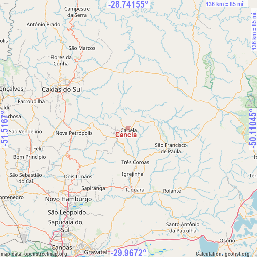
Canela GPS coordinates[2]
29° 21' 22.392" South, 50° 48' 48.852" West
| Map corner | latitude | longitude |
|---|---|---|
| Upper-left | -28.74155°, | -51.5167° |
| Center: | -29.35622°, | -50.81357° |
| Lower-right: | -29.9672°, | -50.11045° |
| Map W x H: | 136.3×136.3 km | = 84.7×84.7mi |
| max Lat: | 2.81972° ⇑96.6% North |
| Canela: | -29.35622° |
| min Lat: | ⇓3.4% South -33.69111° |
| min Long | Canela | max Long |
| -72.89583° | -50.81357° | -32.41083° |
| W 18.4%⇐ | ⇒81.6% E |
Elevation
Elevation of Canela is 826 m = 2710 ft, and this is 445.1 m = 1460 ft above average elevation for this country.
| Max E: |
1603 m = 5259 ft | 9.1% |
| Canela | 826 m 2710 ft | |
| Avg. | 380.9 m = 1250 ft | |
Min E: |
0 m = 0 ft | 90.9% |
See also: Brazil elevation on elevation.city.
Geographical zone
Canela is located in South temperate zone (between Tropic of Capricorn and the Antarctic Circle). Distance of this Southern Tropic circle is 658.2 km =409 mi to North.| Distance of | km | miles | from Canela |
|---|---|---|---|
| Equator | 3264.1 | 2028.2 | to North |
| Tropic Capricorn | 658.2 | 409 | to North |
| Antarctic Circle | 4137.1 | 2570.7 | to South |
| South Pole | 6743 | 4189.9 | to South |


Nearby cities:
15 places around Canela: (largest is in red/bold)
• Caxias do Sul
41.2 km =25.6 mi,  300°
300°
• Estância Velha
47.7 km =29.6 mi,  227°
227°
• Farroupilha
53.8 km =33.4 mi,  285°
285°
• Flores da Cunha
51 km =31.7 mi,  315°
315°
• Igrejinha
24.4 km =15.2 mi,  174°
174°
• Ivoti
42.5 km =26.4 mi, 232°
• Nova Petrópolis
29.2 km =18.1 mi,  265°
265°
• Novo Hamburgo
47.2 km =29.3 mi,  220°
220°
• Parobé
30.4 km =18.9 mi,  183°
183°
• Rolante
40 km =24.9 mi,  144°
144°
• Sapiranga
36.5 km =22.7 mi,  210°
210°
• São Francisco de Paula
24.5 km =15.2 mi,  114°
114°
• São Marcos
49.4 km =30.7 mi,  330°
330°
• Taquara
32.9 km =20.4 mi, 174°
• Três Coroas
18.2 km =11.3 mi, 169°
Sources, notices
• [Note1] Compared only with cities in Brazil existing in our database
• [Src1] Map data: © OpenStreetMap contributors (CC-BY-SA)
• [Src2] Other city data from geonames.org with taken over terms of usage.
• [Src3] Geographical zone / Annual Mean Temperature by Robert A. Rohde @ Wikipedia
