Pinheiral geodata
Pinheiral (Rio de Janeiro) is a populated place; located in Brazil in America/Sao_Paulo (GMT-3) time zone. With population of 19,469 people, there are 965 cities with bigger population in this country. Compared to other cities in Brazil, 73.9% of cities are located further ↑North; 55.9% of cities are located further ←West and 51.7% of cities have lower elevation than Pinheiral. Note1


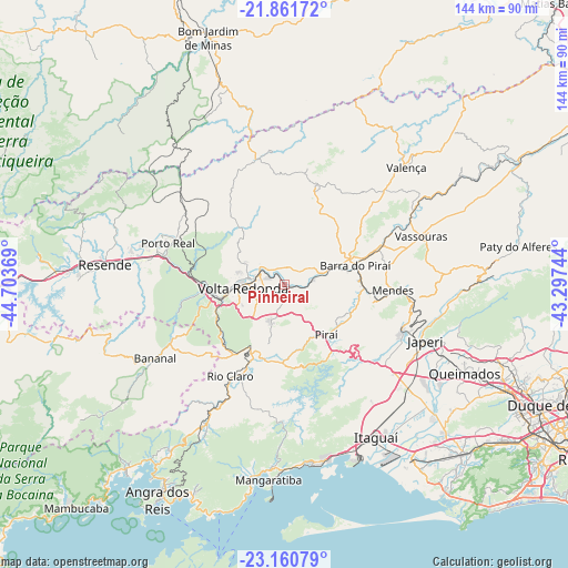
Pinheiral GPS coordinates[2]
22° 30' 46.008" South, 44° 0' 2.016" West
| Map corner | latitude | longitude |
|---|---|---|
| Upper-left | -21.86172°, | -44.70369° |
| Center: | -22.51278°, | -44.00056° |
| Lower-right: | -23.16079°, | -43.29744° |
| Map W x H: | 144.4×144.4 km | = 89.7×89.7mi |
| max Lat: | 2.81972° ⇑73.9% North |
| Pinheiral: | -22.51278° |
| min Lat: | ⇓26.1% South -33.69111° |
| min Long | Pinheiral | max Long |
| -72.89583° | -44.00056° | -32.41083° |
| W 55.9%⇐ | ⇒44.1% E |
Elevation
Elevation of Pinheiral is 375 m = 1230 ft, and this is 5.9 m = 19 ft below average elevation for this country.
| Max E: |
1603 m = 5259 ft | 48.3% |
| Avg. | 380.9 m = 1250 ft | |
| Pinheiral | 375 m = 1230 ft | |
Min E: |
0 m = 0 ft | 51.7% |
See also: Brazil elevation on elevation.city.
Geographical zone
Pinheiral is located in South Torrid zone (between Equator and Tropic of Capricorn). Distance of this Southern Tropic circle is 102.7 km =63.8 mi to South.| Distance of | km | miles | from Pinheiral |
|---|---|---|---|
| Equator | 2503.2 | 1555.4 | to North |
| Tropic Capricorn | 102.7 | 63.8 | to South |
| Antarctic Circle | 4898 | 3043.5 | to South |
| South Pole | 7503.9 | 4662.7 | to South |


Nearby cities:
15 places around Pinheiral: (largest is in red/bold)
• Barra Mansa
17.9 km =11.1 mi,  258°
258°
• Barra do Piraí
18.6 km =11.6 mi,  75°
75°
• Itaguaí
44.3 km =27.5 mi,  148°
148°
• Japeri
38.5 km =23.9 mi,  112°
112°
• Mendes
27.5 km =17.1 mi,  93°
93°
• Paracambi
31.8 km =19.8 mi, 109°
• Piraí
16.7 km =10.4 mi,  140°
140°
• Porto Real
31.5 km =19.6 mi,  289°
289°
• Quatis
28.9 km =18 mi, 293°
• Resende
46.1 km =28.6 mi,  276°
276°
• Rio Claro
27.2 km =16.9 mi,  210°
210°
• Seropédica
39.6 km =24.6 mi,  130°
130°
• Valença
42.8 km =26.6 mi,  46°
46°
• Vassouras
36.8 km =22.9 mi,  70°
70°
• Volta Redonda
10.7 km =6.6 mi, 263°
Sources, notices
• [Note1] Compared only with cities in Brazil existing in our database
• [Src1] Map data: © OpenStreetMap contributors (CC-BY-SA)
• [Src2] Other city data from geonames.org with taken over terms of usage.
• [Src3] Geographical zone / Annual Mean Temperature by Robert A. Rohde @ Wikipedia
