Paty do Alferes geodata
Paty do Alferes (Rio de Janeiro) is a populated place; located in Brazil in America/Sao_Paulo (GMT-3) time zone. With population of 20,659 people, there are 915 cities with bigger population in this country. Compared to other cities in Brazil, 72.9% of cities are located further ↑North; 58.3% of cities are located further ←West and 72.6% of cities have lower elevation than Paty do Alferes. Note1


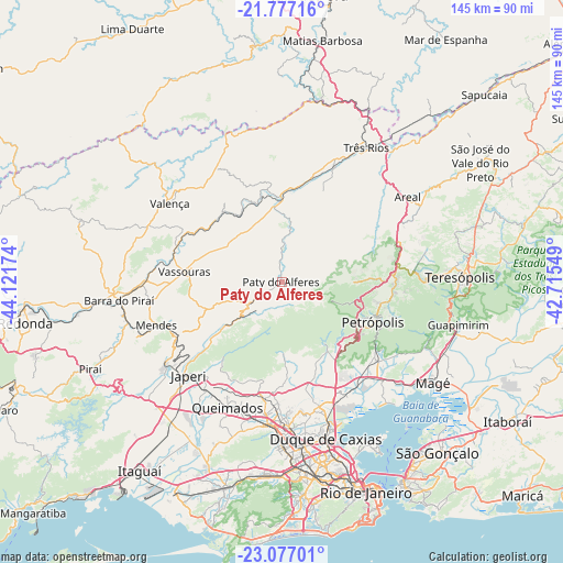
Paty do Alferes GPS coordinates[2]
22° 25' 42.996" South, 43° 25' 6.996" West
| Map corner | latitude | longitude |
|---|---|---|
| Upper-left | -21.77716°, | -44.12174° |
| Center: | -22.42861°, | -43.41861° |
| Lower-right: | -23.07701°, | -42.71549° |
| Map W x H: | 144.5×144.5 km | = 89.8×89.8mi |
| max Lat: | 2.81972° ⇑72.9% North |
| Paty do Alferes: | -22.42861° |
| min Lat: | ⇓27.1% South -33.69111° |
| min Long | Paty do Alferes | max Long |
| -72.89583° | -43.41861° | -32.41083° |
| W 58.3%⇐ | ⇒41.7% E |
Elevation
Elevation of Paty do Alferes is 599 m = 1965 ft, and this is 218.1 m = 716 ft above average elevation for this country.
| Max E: |
1603 m = 5259 ft | 27.4% |
| Paty do Alferes | 599 m 1965 ft | |
| Avg. | 380.9 m = 1250 ft | |
Min E: |
0 m = 0 ft | 72.6% |
See also: Brazil elevation on elevation.city.
Geographical zone
Paty do Alferes is located in South Torrid zone (between Equator and Tropic of Capricorn). Distance of this Southern Tropic circle is 112.1 km =69.7 mi to South.| Distance of | km | miles | from Paty do Alferes |
|---|---|---|---|
| Equator | 2493.8 | 1549.6 | to North |
| Tropic Capricorn | 112.1 | 69.7 | to South |
| Antarctic Circle | 4907.3 | 3049.3 | to South |
| South Pole | 7513.2 | 4668.5 | to South |


Nearby cities:
15 places around Paty do Alferes: (largest is in red/bold)
• Areal
39 km =24.2 mi,  55°
55°
• Belford Roxo
37.4 km =23.2 mi,  176°
176°
• Duque de Caxias
41.2 km =25.6 mi,  164°
164°
• Japeri
33.9 km =21.1 mi,  225°
225°
• Mendes
34.1 km =21.2 mi,  251°
251°
• Miguel Pereira
5.9 km =3.7 mi,  241°
241°
• Nova Iguaçu
36.9 km =22.9 mi,  185°
185°
• Paracambi
35.8 km =22.2 mi, 236°
• Paraíba do Sul
32.7 km =20.3 mi,  23°
23°
• Petrópolis
26.1 km =16.2 mi,  109°
109°
• Queimados
34.9 km =21.7 mi,  203°
203°
• São João de Meriti
42 km =26.1 mi,  173°
173°
• Três Rios
40.8 km =25.4 mi,  31°
31°
• Valença
35.4 km =22 mi,  305°
305°
• Vassouras
25.2 km =15.7 mi,  276°
276°
Sources, notices
• [Note1] Compared only with cities in Brazil existing in our database
• [Src1] Map data: © OpenStreetMap contributors (CC-BY-SA)
• [Src2] Other city data from geonames.org with taken over terms of usage.
• [Src3] Geographical zone / Annual Mean Temperature by Robert A. Rohde @ Wikipedia
