Monte Alegre de Sergipe geodata
Monte Alegre de Sergipe (Sergipe) is a populated place; located in Brazil in America/Maceio (GMT-3) time zone. With population of 6,816 people, there are 1841 cities with bigger population in this country. Compared to other cities in Brazil, 67.8% of cities are located further ↓South; 86.4% of cities are located further ←West and 55.5% of cities have higher elevation than Monte Alegre de Sergipe. Note1
Current local time in Monte Alegre de Sergipe:
06:46 PM, TuesdayDifference from your time zone: hours


Monte Alegre de Sergipe GPS coordinates[2]
10° 1' 37.992" South, 37° 33' 43.992" West
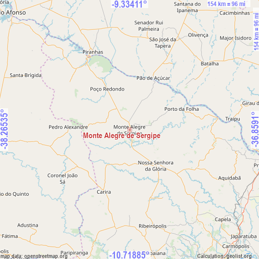
| Map corner | latitude | longitude |
|---|---|---|
| Upper-left | -9.33411°, | -38.26535° |
| Center: | -10.02722°, | -37.56222° |
| Lower-right: | -10.71885°, | -36.8591° |
| Map W x H: | 154×154 km | = 95.7×95.7mi |
| max Lat: | 2.81972° ⇑32.2% North |
| Monte Alegre de Sergipe: | -10.02722° |
| min Lat: | ⇓67.8% South -33.69111° |
| min Long | Monte Alegre de | max Long |
| -72.89583° | -37.56222° | -32.41083° |
| W 86.4%⇐ | ⇒13.6% E |
Elevation
Elevation of Monte Alegre de Sergipe is 262 m = 860 ft, and this is 118.9 m = 390 ft below average elevation for this country.
| Max E: |
1603 m = 5259 ft | 55.5% |
| Avg. | 380.9 m = 1250 ft | |
| Monte Alegre de Sergipe | 262 m = 860 ft | |
Min E: |
0 m = 0 ft | 44.5% |
See also: Brazil elevation on elevation.city.
Geographical zone
Monte Alegre de Sergipe is located in South Torrid zone (between Equator and Tropic of Capricorn). Distance of Equator is 1114.9 km =692.8 mi to North.| Distance of | km | miles | from Monte Alegre de Sergipe |
|---|---|---|---|
| Equator | 1114.9 | 692.8 | to North |
| Tropic Capricorn | 1491 | 926.5 | to South |
| Antarctic Circle | 6286.3 | 3906.1 | to South |
| South Pole | 8892.1 | 5525.3 | to South |


Nearby cities:
15 places around Monte Alegre de Sergipe: (largest is in red/bold)
• Aquidabã
65.9 km =40.9 mi,  115°
115°
• Batalha
61.7 km =38.3 mi,  50°
50°
• Canindé de São Francisco
47.8 km =29.7 mi,  328°
328°
• Carira
40.1 km =24.9 mi,  202°
202°
• Frei Paulo
58.1 km =36.1 mi,  177°
177°
• Gararu
52.9 km =32.9 mi,  82°
82°
• Moita Bonita
65.7 km =40.8 mi,  158°
158°
• Nossa Senhora da Glória
26.3 km =16.3 mi,  143°
143°
• Nossa Senhora das Dores
65.5 km =40.7 mi, 141°
• Olivença
69.7 km =43.3 mi,  35°
35°
• Porto da Folha
33.4 km =20.8 mi,  68°
68°
• Pão de Açúcar
33.9 km =21.1 mi,  23°
23°
• Ribeirópolis
59.1 km =36.7 mi, 164°
• São José da Tapera
55.8 km =34.7 mi, 20°
• Traipu
61.5 km =38.2 mi, 84°
Sources, notices
• [Note1] Compared only with cities in Brazil existing in our database
• [Src1] Map data: © OpenStreetMap contributors (CC-BY-SA)
• [Src2] Other city data from geonames.org with taken over terms of usage.
• [Src3] Geographical zone / Annual Mean Temperature by Robert A. Rohde @ Wikipedia
