Jaú geodata
Jaú (São Paulo) is a populated place; located in Brazil in America/Sao_Paulo (GMT-3) time zone. With population of 119,206 people, there are 189 cities with bigger population in this country. Compared to other cities in Brazil, 72% of cities are located further ↑North; 68.2% of cities are located further →East and 65.3% of cities have lower elevation than Jaú. Note1


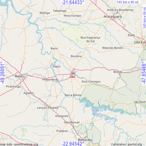
Jaú GPS coordinates[2]
22° 17' 47.004" South, 48° 33' 28.008" West
| Map corner | latitude | longitude |
|---|---|---|
| Upper-left | -21.64433°, | -49.26091° |
| Center: | -22.29639°, | -48.55778° |
| Lower-right: | -22.94542°, | -47.85466° |
| Map W x H: | 144.7×144.7 km | = 89.9×89.9mi |
| max Lat: | 2.81972° ⇑72% North |
| Jaú: | -22.29639° |
| min Lat: | ⇓28% South -33.69111° |
| min Long | Jaú | max Long |
| -72.89583° | -48.55778° | -32.41083° |
| W 31.8%⇐ | ⇒68.2% E |
Elevation
Elevation of Jaú is 528 m = 1732 ft, and this is 147.1 m = 483 ft above average elevation for this country.
| Max E: |
1603 m = 5259 ft | 34.7% |
| Jaú | 528 m 1732 ft | |
| Avg. | 380.9 m = 1250 ft | |
Min E: |
0 m = 0 ft | 65.3% |
See also: Jaú elevation on elevation.city.
Geographical zone
Jaú is located in South Torrid zone (between Equator and Tropic of Capricorn). Distance of this Southern Tropic circle is 126.8 km =78.8 mi to South.| Distance of | km | miles | from Jaú |
|---|---|---|---|
| Equator | 2479.1 | 1540.4 | to North |
| Tropic Capricorn | 126.8 | 78.8 | to South |
| Antarctic Circle | 4922 | 3058.4 | to South |
| South Pole | 7527.9 | 4677.6 | to South |


Nearby cities:
15 places around Jaú: (largest is in red/bold)
• Agudos
48.2 km =30 mi,  246°
246°
• Bariri
31 km =19.3 mi,  322°
322°
• Barra Bonita
22.1 km =13.7 mi,  180°
180°
• Bauru
51.8 km =32.2 mi,  267°
267°
• Boa Esperança do Sul
37.9 km =23.5 mi,  26°
26°
• Boracéia
25.5 km =15.8 mi,  296°
296°
• Brotas
44.4 km =27.6 mi,  88°
88°
• Dois Córregos
19.8 km =12.3 mi,  113°
113°
• Igaraçu do Tietê
23.7 km =14.7 mi, 180°
• Itapuí
18 km =11.2 mi,  292°
292°
• Lençóis Paulista
41.8 km =26 mi,  216°
216°
• Macatuba
27.8 km =17.3 mi,  214°
214°
• Pederneiras
23.2 km =14.4 mi, 254°
• Ribeirão Bonito
46.9 km =29.1 mi,  56°
56°
• São Manuel
48.4 km =30.1 mi, 181°
Sources, notices
• [Note1] Compared only with cities in Brazil existing in our database
• [Src1] Map data: © OpenStreetMap contributors (CC-BY-SA)
• [Src2] Other city data from geonames.org with taken over terms of usage.
• [Src3] Geographical zone / Annual Mean Temperature by Robert A. Rohde @ Wikipedia
