Vselyub geodata
Vselyub (Grodnenskaya) is a populated place; located in Belarus in Europe/Minsk (GMT+3) time zone. With population of 603 people, there are 283 cities with bigger population in this country. Compared to other cities in Belarus, 53% of cities are located further ↑North; 84.9% of cities are located further →East and 84.5% of cities have lower elevation than Vselyub. Note1


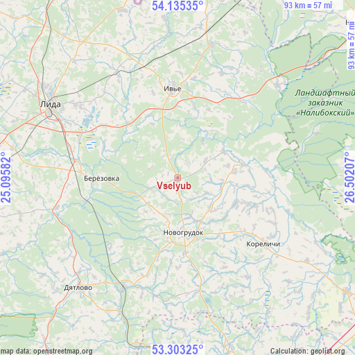
Vselyub GPS coordinates[2]
53° 43' 16.896" North, 25° 47' 56.184" East
| Map corner | latitude | longitude |
|---|---|---|
| Upper-left | 54.13535°, | 25.09582° |
| Center: | 53.72136°, | 25.79894° |
| Lower-right: | 53.30325°, | 26.50207° |
| Map W x H: | 92.5×92.5 km | = 57.5×57.5mi |
| max Lat: | 56.0147° ⇑53% North |
| Vselyub: | 53.72136° |
| min Lat: | ⇓47% South 51.75° |
| min Long | Vselyub | max Long |
| 23.37083° | 25.79894° | 32.578° |
| W 15.1%⇐ | ⇒84.9% E |
Elevation
Elevation of Vselyub is 201 m = 659 ft, and this is 32.4 m = 106 ft above average elevation for this country.
| Max E: |
309 m = 1014 ft | 15.5% |
| Vselyub | 201 m 659 ft | |
| Avg. | 168.6 m = 553 ft | |
Min E: |
108 m = 354 ft | 84.5% |
See also: Belarus elevation on elevation.city.
Geographical zone
Vselyub is located in North temperate zone (between Tropic of Cancer and the Arctic Circle). Distance of this North polar circle is 1427.9 km =887.3 mi to North.| Distance of | km | miles | from Vselyub |
|---|---|---|---|
| North Pole | 4033.8 | 2506.5 | to North |
| Arctic Circle | 1427.9 | 887.3 | to North |
| Tropic Cancer | 3367.3 | 2092.3 | to South |
| Equator | 5973.3 | 3711.6 | to South |


Nearby cities:
15 places around Vselyub: (largest is in red/bold)
• Byarozawka
19.9 km =12.4 mi,  270°
270°
• Byelagruda
42.5 km =26.4 mi,  282°
282°
• Dyatlovo
38.7 km =24 mi,  222°
222°
• Haradzishcha
46.3 km =28.8 mi,  162°
162°
• Hyeranyony
46.2 km =28.7 mi,  341°
341°
• Iwye
23.3 km =14.5 mi,  355°
355°
• Karelichy
28.5 km =17.7 mi,  127°
127°
• Lida
37.4 km =23.2 mi,  298°
298°
• Lyubcha
17.5 km =10.9 mi,  78°
78°
• Mir
53.2 km =33.1 mi,  123°
123°
• Novogrudok
14.2 km =8.8 mi,  174°
174°
• Shchorsy
27.2 km =16.9 mi,  110°
110°
• Traby
49.1 km =30.5 mi,  8°
8°
• Turets
40.2 km =25 mi, 122°
• Zhaludok
55.5 km =34.5 mi,  255°
255°
Sources, notices
• [Note1] Compared only with cities in Belarus existing in our database
• [Src1] Map data: © OpenStreetMap contributors (CC-BY-SA)
• [Src2] Other city data from geonames.org with taken over terms of usage.
• [Src3] Geographical zone / Annual Mean Temperature by Robert A. Rohde @ Wikipedia
