Banff geodata
Banff (Alberta) is a populated place; located in Canada in America/Edmonton (GMT-6) time zone. With population of 7,502 people, there are 382 cities with bigger population in this country. Compared to other cities in Canada, 83% of cities are located further ↓South; 83.7% of cities are located further →East and 99.9% of cities have lower elevation than Banff. Note1


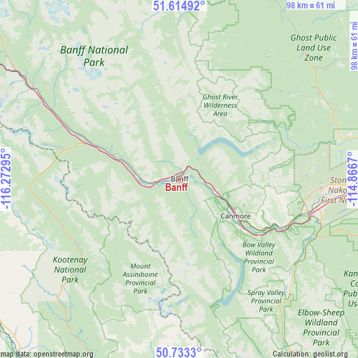
Banff GPS coordinates[2]
51° 10' 34.392" North, 115° 34' 11.352" West
| Map corner | latitude | longitude |
|---|---|---|
| Upper-left | 51.61492°, | -116.27295° |
| Center: | 51.17622°, | -115.56982° |
| Lower-right: | 50.7333°, | -114.8667° |
| Map W x H: | 98×98 km | = 60.9×60.9mi |
| max Lat: | 73.03752° ⇑17% North |
| Banff: | 51.17622° |
| min Lat: | ⇓83% South 42.05009° |
| min Long | Banff | max Long |
| -139.43328° | -115.56982° | -52.70931° |
| W 16.3%⇐ | ⇒83.7% E |
Elevation
Elevation of Banff is 1388 m = 4554 ft, and this is 1133.6 m = 3719 ft above average elevation for this country.
| Max E: |
1518 m = 4980 ft | 0.099999999999994% |
| Banff | 1388 m 4554 ft | |
| Avg. | 254.4 m = 835 ft | |
Min E: |
-2 m = -7 ft | 99.9% |
See also: Canada elevation on elevation.city.
Geographical zone
Banff is located in North temperate zone (between Tropic of Cancer and the Arctic Circle). Distance of this North polar circle is 1710.9 km =1063.1 mi to North.| Distance of | km | miles | from Banff |
|---|---|---|---|
| North Pole | 4316.8 | 2682.3 | to North |
| Arctic Circle | 1710.9 | 1063.1 | to North |
| Tropic Cancer | 3084.3 | 1916.5 | to South |
| Equator | 5690.3 | 3535.8 | to South |


Nearby cities:
15 places around Banff: (largest is in red/bold)
• Airdrie
107.7 km =66.9 mi,  82°
82°
• Black Diamond
107.4 km =66.7 mi,  119°
119°
• Bragg Creek
74.8 km =46.5 mi,  109°
109°
• Calgary
104.6 km =65 mi,  97°
97°
• Canmore
18.4 km =11.4 mi, 124°
• Carstairs
110.8 km =68.8 mi,  66°
66°
• Cochrane
76.8 km =47.7 mi,  89°
89°
• Crossfield
110.4 km =68.6 mi, 74°
• Didsbury
113.4 km =70.5 mi,  61°
61°
• Golden
98.4 km =61.1 mi,  278°
278°
• Heritage Pointe
115.6 km =71.8 mi, 108°
• Invermere
80.3 km =49.9 mi,  204°
204°
• Okotoks
121.8 km =75.7 mi, 114°
• Olds
122 km =75.8 mi, 56°
• Sundre
94.9 km =59 mi,  43°
43°
Sources, notices
• [Note1] Compared only with cities in Canada existing in our database
• [Src1] Map data: © OpenStreetMap contributors (CC-BY-SA)
• [Src2] Other city data from geonames.org with taken over terms of usage.
• [Src3] Geographical zone / Annual Mean Temperature by Robert A. Rohde @ Wikipedia
