Manitouwadge geodata
Manitouwadge (Ontario) is a populated place; located in Canada in America/Toronto (GMT-4) time zone. With population of 1,708 people, there are 808 cities with bigger population in this country. Compared to other cities in Canada, 64% of cities are located further ↓South; 63.8% of cities are located further →East and 72.5% of cities have lower elevation than Manitouwadge. Note1


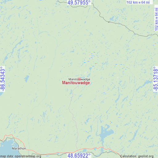
Manitouwadge GPS coordinates[2]
49° 7' 17.472" North, 85° 50' 25.08" West
| Map corner | latitude | longitude |
|---|---|---|
| Upper-left | 49.57955°, | -86.54343° |
| Center: | 49.12152°, | -85.8403° |
| Lower-right: | 48.65922°, | -85.13718° |
| Map W x H: | 102.3×102.3 km | = 63.6×63.6mi |
| max Lat: | 73.03752° ⇑36% North |
| Manitouwadge: | 49.12152° |
| min Lat: | ⇓64% South 42.05009° |
| min Long | Manitouwadge | max Long |
| -139.43328° | -85.8403° | -52.70931° |
| W 36.2%⇐ | ⇒63.8% E |
Elevation
Elevation of Manitouwadge is 331 m = 1086 ft, and this is 76.6 m = 251 ft above average elevation for this country.
| Max E: |
1518 m = 4980 ft | 27.5% |
| Manitouwadge | 331 m 1086 ft | |
| Avg. | 254.4 m = 835 ft | |
Min E: |
-2 m = -7 ft | 72.5% |
See also: Canada elevation on elevation.city.
Geographical zone
Manitouwadge is located in North temperate zone (between Tropic of Cancer and the Arctic Circle). Distance of this North polar circle is 1939.4 km =1205.1 mi to North.| Distance of | km | miles | from Manitouwadge |
|---|---|---|---|
| North Pole | 4545.3 | 2824.3 | to North |
| Arctic Circle | 1939.4 | 1205.1 | to North |
| Tropic Cancer | 2855.9 | 1774.6 | to South |
| Equator | 5461.8 | 3393.8 | to South |


Nearby cities:
11 places around Manitouwadge: (largest is in red/bold)
• Greenstone
117.6 km =73.1 mi,  305°
305°
• Hearst
169.2 km =105.1 mi,  68°
68°
• Hornepayne
78.1 km =48.5 mi,  82°
82°
• Kapuskasing
249.4 km =155 mi, 82°
• Lappe
264.1 km =164.1 mi,  256°
256°
• Marathon
59.8 km =37.2 mi,  226°
226°
• Neebing
283.4 km =176.1 mi,  248°
248°
• Sault Ste. Marie
310.7 km =193.1 mi,  158°
158°
• Thessalon
361.8 km =224.8 mi,  151°
151°
• Thunder Bay
263.1 km =163.5 mi, 251°
• Wawa
148.4 km =92.2 mi, 148°
Sources, notices
• [Note1] Compared only with cities in Canada existing in our database
• [Src1] Map data: © OpenStreetMap contributors (CC-BY-SA)
• [Src2] Other city data from geonames.org with taken over terms of usage.
• [Src3] Geographical zone / Annual Mean Temperature by Robert A. Rohde @ Wikipedia
