Hornepayne geodata
Hornepayne (Ontario) is a populated place; located in Canada in America/Toronto (GMT-4) time zone. With population of 1,050 people, there are 1025 cities with bigger population in this country. Compared to other cities in Canada, 66.2% of cities are located further ↓South; 63.6% of cities are located further →East and 72.1% of cities have lower elevation than Hornepayne. Note1


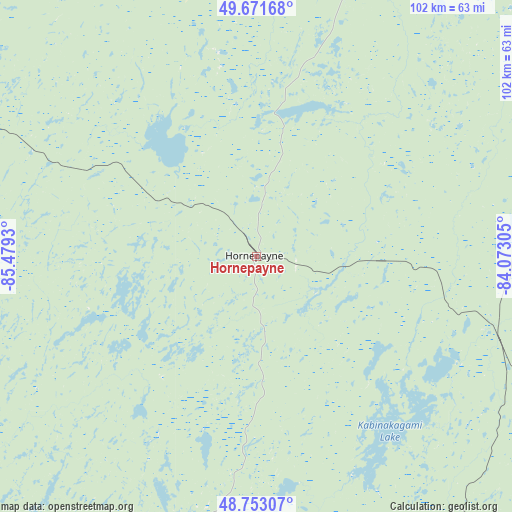
Hornepayne GPS coordinates[2]
49° 12' 52.236" North, 84° 46' 34.212" West
| Map corner | latitude | longitude |
|---|---|---|
| Upper-left | 49.67168°, | -85.4793° |
| Center: | 49.21451°, | -84.77617° |
| Lower-right: | 48.75307°, | -84.07305° |
| Map W x H: | 102.1×102.1 km | = 63.4×63.4mi |
| max Lat: | 73.03752° ⇑33.8% North |
| Hornepayne: | 49.21451° |
| min Lat: | ⇓66.2% South 42.05009° |
| min Long | Hornepayne | max Long |
| -139.43328° | -84.77617° | -52.70931° |
| W 36.4%⇐ | ⇒63.6% E |
Elevation
Elevation of Hornepayne is 330 m = 1083 ft, and this is 75.6 m = 248 ft above average elevation for this country.
| Max E: |
1518 m = 4980 ft | 27.9% |
| Hornepayne | 330 m 1083 ft | |
| Avg. | 254.4 m = 835 ft | |
Min E: |
-2 m = -7 ft | 72.1% |
See also: Canada elevation on elevation.city.
Geographical zone
Hornepayne is located in North temperate zone (between Tropic of Cancer and the Arctic Circle). Distance of this North polar circle is 1929 km =1198.6 mi to North.| Distance of | km | miles | from Hornepayne |
|---|---|---|---|
| North Pole | 4534.9 | 2817.9 | to North |
| Arctic Circle | 1929 | 1198.6 | to North |
| Tropic Cancer | 2866.2 | 1781 | to South |
| Equator | 5472.1 | 3400.2 | to South |


Nearby cities:
11 places around Hornepayne: (largest is in red/bold)
• Elliot Lake
353.1 km =219.4 mi,  153°
153°
• Greenstone
182.1 km =113.2 mi,  288°
288°
• Hearst
95.7 km =59.5 mi,  56°
56°
• Kapuskasing
171.3 km =106.4 mi,  82°
82°
• Manitouwadge
78.1 km =48.5 mi,  262°
262°
• Marathon
131.5 km =81.7 mi,  246°
246°
• Sault Ste. Marie
301.8 km =187.5 mi,  173°
173°
• Spanish
381.1 km =236.8 mi, 151°
• Thessalon
341.8 km =212.4 mi,  164°
164°
• Timmins
265.3 km =164.8 mi,  108°
108°
• Wawa
136.3 km =84.7 mi,  179°
179°
Sources, notices
• [Note1] Compared only with cities in Canada existing in our database
• [Src1] Map data: © OpenStreetMap contributors (CC-BY-SA)
• [Src2] Other city data from geonames.org with taken over terms of usage.
• [Src3] Geographical zone / Annual Mean Temperature by Robert A. Rohde @ Wikipedia
