Saint-Côme--Linière geodata
Saint-Côme--Linière (Quebec) is a populated place; located in Canada in America/Toronto (GMT-4) time zone. With population of 2,167 people, there are 723 cities with bigger population in this country. Compared to other cities in Canada, 61.9% of cities are located further ↑North; 82.2% of cities are located further ←West and 70.8% of cities have lower elevation than Saint-Côme--Linière. Note1
Administrative division(s):
- Level 1: Quebec
- Level 2: Chaudière-Appalaches
- Level 3: Saint-Come-Liniere


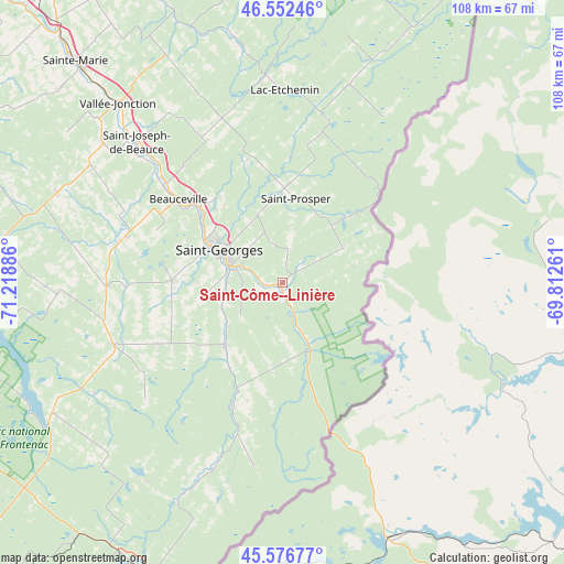
Saint-Côme--Linière GPS coordinates[2]
46° 4' 0.372" North, 70° 30' 56.628" West
| Map corner | latitude | longitude |
|---|---|---|
| Upper-left | 46.55246°, | -71.21886° |
| Center: | 46.06677°, | -70.51573° |
| Lower-right: | 45.57677°, | -69.81261° |
| Map W x H: | 108.5×108.5 km | = 67.4×67.4mi |
| max Lat: | 73.03752° ⇑61.9% North |
| Saint-Côme--Linière: | 46.06677° |
| min Lat: | ⇓38.1% South 42.05009° |
| min Long | Saint-Côme--Li | max Long |
| -139.43328° | -70.51573° | -52.70931° |
| W 82.2%⇐ | ⇒17.8% E |
Elevation
Elevation of Saint-Côme--Linière is 310 m = 1017 ft, and this is 55.6 m = 182 ft above average elevation for this country.
| Max E: |
1518 m = 4980 ft | 29.2% |
| Saint-Côme--Linière | 310 m 1017 ft | |
| Avg. | 254.4 m = 835 ft | |
Min E: |
-2 m = -7 ft | 70.8% |
See also: Canada elevation on elevation.city.
Geographical zone
Saint-Côme--Linière is located in North temperate zone (between Tropic of Cancer and the Arctic Circle). Distance of this North polar circle is 2279 km =1416.1 mi to North.| Distance of | km | miles | from Saint-Côme--Linière |
|---|---|---|---|
| North Pole | 4884.9 | 3035.3 | to North |
| Arctic Circle | 2279 | 1416.1 | to North |
| Tropic Cancer | 2516.2 | 1563.5 | to South |
| Equator | 5122.1 | 3182.7 | to South |


Nearby cities:
15 places around Saint-Côme--Linière: (largest is in red/bold)
• Adstock
43.8 km =27.2 mi,  267°
267°
• Beauceville
26.3 km =16.3 mi,  309°
309°
• Disraeli
67 km =41.6 mi,  253°
253°
• East Broughton
46.2 km =28.7 mi,  290°
290°
• Lac-Mégantic
60.8 km =37.8 mi,  207°
207°
• Linière
10.7 km =6.6 mi,  133°
133°
• Saint-Georges
12.6 km =7.8 mi, 294°
• Saint-Joseph-de-Beauce
37.4 km =23.2 mi, 313°
• Saint-Joseph-de-Coleraine
66.6 km =41.4 mi,  260°
260°
• Saint-Théophile
15.1 km =9.4 mi,  170°
170°
• Saint-Éphrem-de-Beauce
33.4 km =20.8 mi, 270°
• Sainte-Marie
55.9 km =34.7 mi,  316°
316°
• Shenley
25.5 km =15.8 mi, 253°
• Thetford-Mines
61 km =37.9 mi, 272°
• Vallée-Jonction
46.2 km =28.7 mi, 317°
Sources, notices
• [Note1] Compared only with cities in Canada existing in our database
• [Src1] Map data: © OpenStreetMap contributors (CC-BY-SA)
• [Src2] Other city data from geonames.org with taken over terms of usage.
• [Src3] Geographical zone / Annual Mean Temperature by Robert A. Rohde @ Wikipedia
