Saint-Damase geodata
Saint-Damase (Quebec) is a populated place; located in Canada in America/Toronto (GMT-4) time zone. With population of 1,349 people, there are 902 cities with bigger population in this country. Compared to other cities in Canada, 73.6% of cities are located further ↑North; 72.2% of cities are located further ←West and 81.3% of cities have higher elevation than Saint-Damase. Note1


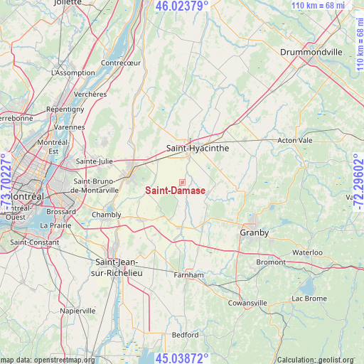
Saint-Damase GPS coordinates[2]
45° 32' 0.276" North, 72° 59' 56.904" West
| Map corner | latitude | longitude |
|---|---|---|
| Upper-left | 46.02379°, | -73.70227° |
| Center: | 45.53341°, | -72.99914° |
| Lower-right: | 45.03872°, | -72.29602° |
| Map W x H: | 109.5×109.5 km | = 68×68mi |
| max Lat: | 73.03752° ⇑73.6% North |
| Saint-Damase: | 45.53341° |
| min Lat: | ⇓26.4% South 42.05009° |
| min Long | Saint-Damase | max Long |
| -139.43328° | -72.99914° | -52.70931° |
| W 72.2%⇐ | ⇒27.8% E |
Elevation
Elevation of Saint-Damase is 30 m = 98 ft, and this is 224.4 m = 736 ft below average elevation for this country.
| Max E: |
1518 m = 4980 ft | 81.3% |
| Avg. | 254.4 m = 835 ft | |
| Saint-Damase | 30 m = 98 ft | |
Min E: |
-2 m = -7 ft | 18.7% |
See also: Canada elevation on elevation.city.
Geographical zone
Saint-Damase is located in North temperate zone (between Tropic of Cancer and the Arctic Circle). Distance of this North polar circle is 2338.3 km =1453 mi to North.| Distance of | km | miles | from Saint-Damase |
|---|---|---|---|
| North Pole | 4944.2 | 3072.2 | to North |
| Arctic Circle | 2338.3 | 1453 | to North |
| Tropic Cancer | 2456.9 | 1526.6 | to South |
| Equator | 5062.8 | 3145.9 | to South |


Nearby cities:
15 places around Saint-Damase: (largest is in red/bold)
• Ange-Gardien
21 km =13 mi,  165°
165°
• Beloeil
16.5 km =10.3 mi,  283°
283°
• Chambly
23.9 km =14.9 mi,  247°
247°
• Marieville
17.1 km =10.6 mi,  229°
229°
• Mont-Saint-Hilaire
15 km =9.3 mi, 283°
• Otterburn Park
16.9 km =10.5 mi,  269°
269°
• Richelieu
21.7 km =13.5 mi,  242°
242°
• Rougemont
11.8 km =7.3 mi,  199°
199°
• Saint-Barnabé-Sud
22.6 km =14 mi,  15°
15°
• Saint-Basile-le-Grand
22.1 km =13.7 mi, 269°
• Saint-Césaire
13 km =8.1 mi,  180°
180°
• Saint-Hyacinthe
11.3 km =7 mi, 16°
• Saint-Liboire
22.5 km =14 mi,  54°
54°
• Saint-Pie
7.8 km =4.8 mi,  115°
115°
• Sainte-Madeleine
10.7 km =6.6 mi,  313°
313°
Sources, notices
• [Note1] Compared only with cities in Canada existing in our database
• [Src1] Map data: © OpenStreetMap contributors (CC-BY-SA)
• [Src2] Other city data from geonames.org with taken over terms of usage.
• [Src3] Geographical zone / Annual Mean Temperature by Robert A. Rohde @ Wikipedia
