Saint-Hyacinthe geodata
Saint-Hyacinthe (Quebec) is a populated place; located in Canada in America/Toronto (GMT-4) time zone. With population of 50,326 people, there are 101 cities with bigger population in this country. Compared to other cities in Canada, 71.1% of cities are located further ↑North; 72.6% of cities are located further ←West and 79.8% of cities have higher elevation than Saint-Hyacinthe. Note1


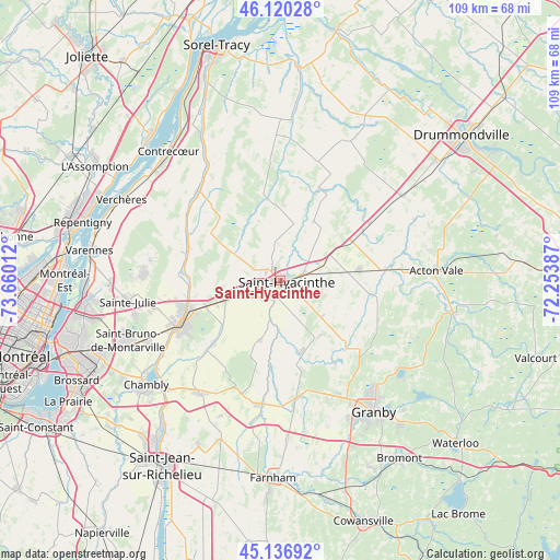
Saint-Hyacinthe GPS coordinates[2]
45° 37' 50.736" North, 72° 57' 25.164" West
| Map corner | latitude | longitude |
|---|---|---|
| Upper-left | 46.12028°, | -73.66012° |
| Center: | 45.63076°, | -72.95699° |
| Lower-right: | 45.13692°, | -72.25387° |
| Map W x H: | 109.3×109.3 km | = 67.9×67.9mi |
| max Lat: | 73.03752° ⇑71.1% North |
| Saint-Hyacinthe: | 45.63076° |
| min Lat: | ⇓28.9% South 42.05009° |
| min Long | Saint-Hyacinthe | max Long |
| -139.43328° | -72.95699° | -52.70931° |
| W 72.6%⇐ | ⇒27.4% E |
Elevation
Elevation of Saint-Hyacinthe is 32 m = 105 ft, and this is 222.4 m = 730 ft below average elevation for this country.
| Max E: |
1518 m = 4980 ft | 79.8% |
| Avg. | 254.4 m = 835 ft | |
| Saint-Hyacinthe | 32 m = 105 ft | |
Min E: |
-2 m = -7 ft | 20.2% |
See also: Saint-Hyacinthe elevation on elevation.city.
Geographical zone
Saint-Hyacinthe is located in North temperate zone (between Tropic of Cancer and the Arctic Circle). Distance of this North polar circle is 2327.5 km =1446.2 mi to North.| Distance of | km | miles | from Saint-Hyacinthe |
|---|---|---|---|
| North Pole | 4933.4 | 3065.5 | to North |
| Arctic Circle | 2327.5 | 1446.2 | to North |
| Tropic Cancer | 2467.7 | 1533.4 | to South |
| Equator | 5073.7 | 3152.7 | to South |


Nearby cities:
15 places around Saint-Hyacinthe: (largest is in red/bold)
• Beloeil
20.6 km =12.8 mi,  250°
250°
• Marieville
27.3 km =17 mi,  216°
216°
• Mont-Saint-Hilaire
19.3 km =12 mi, 247°
• Otterburn Park
22.9 km =14.2 mi,  241°
241°
• Rougemont
23.1 km =14.4 mi,  198°
198°
• Saint-Amable
26.7 km =16.6 mi,  274°
274°
• Saint-Barnabé-Sud
11.3 km =7 mi,  13°
13°
• Saint-Basile-le-Grand
27.5 km =17.1 mi, 246°
• Saint-Césaire
24 km =14.9 mi,  187°
187°
• Saint-Damase
11.3 km =7 mi, 196°
• Saint-Denis-sur-Richelieu
22.6 km =14 mi,  318°
318°
• Saint-Liboire
15.2 km =9.4 mi,  81°
81°
• Saint-Pie
14.7 km =9.1 mi,  165°
165°
• Sainte-Julie
29.7 km =18.5 mi,  259°
259°
• Sainte-Madeleine
11.6 km =7.2 mi, 252°
Sources, notices
• [Note1] Compared only with cities in Canada existing in our database
• [Src1] Map data: © OpenStreetMap contributors (CC-BY-SA)
• [Src2] Other city data from geonames.org with taken over terms of usage.
• [Src3] Geographical zone / Annual Mean Temperature by Robert A. Rohde @ Wikipedia
