Saint-Jean-Baptiste geodata
Saint-Jean-Baptiste (Quebec) is a populated place; located in Canada in America/Toronto (GMT-4) time zone. With population of 1,703 people, there are 810 cities with bigger population in this country. Compared to other cities in Canada, 79% of cities are located further ↑North; 62.2% of cities are located further ←West and 84.1% of cities have higher elevation than Saint-Jean-Baptiste. Note1


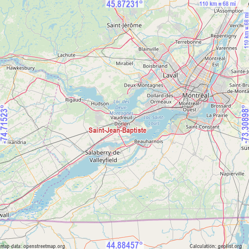
Saint-Jean-Baptiste GPS coordinates[2]
45° 22' 50.16" North, 74° 0' 43.56" West
| Map corner | latitude | longitude |
|---|---|---|
| Upper-left | 45.87231°, | -74.71523° |
| Center: | 45.3806°, | -74.0121° |
| Lower-right: | 44.88457°, | -73.30898° |
| Map W x H: | 109.8×109.8 km | = 68.2×68.2mi |
| max Lat: | 73.03752° ⇑79% North |
| Saint-Jean-Baptiste: | 45.3806° |
| min Lat: | ⇓21% South 42.05009° |
| min Long | Saint-Jean-Bapt | max Long |
| -139.43328° | -74.0121° | -52.70931° |
| W 62.2%⇐ | ⇒37.8% E |
Elevation
Elevation of Saint-Jean-Baptiste is 24 m = 79 ft, and this is 230.4 m = 756 ft below average elevation for this country.
| Max E: |
1518 m = 4980 ft | 84.1% |
| Avg. | 254.4 m = 835 ft | |
| Saint-Jean-Baptiste | 24 m = 79 ft | |
Min E: |
-2 m = -7 ft | 15.9% |
See also: Canada elevation on elevation.city.
Geographical zone
Saint-Jean-Baptiste is located in North temperate zone (between Tropic of Cancer and the Arctic Circle). Distance of this North polar circle is 2355.3 km =1463.5 mi to North.| Distance of | km | miles | from Saint-Jean-Baptiste |
|---|---|---|---|
| North Pole | 4961.2 | 3082.7 | to North |
| Arctic Circle | 2355.3 | 1463.5 | to North |
| Tropic Cancer | 2439.9 | 1516.1 | to South |
| Equator | 5045.8 | 3135.3 | to South |


Nearby cities:
15 places around Saint-Jean-Baptiste: (largest is in red/bold)
• Baie-D'Urfé
8.4 km =5.2 mi,  63°
63°
• Beaconsfield
12.8 km =8 mi, 62°
• Beauharnois
13.2 km =8.2 mi,  124°
124°
• Hudson
13.2 km =8.2 mi,  305°
305°
• Kirkland
13.8 km =8.6 mi, 55°
• L'Île-Perrot
4.9 km =3 mi,  86°
86°
• Les Cèdres
9.4 km =5.8 mi,  197°
197°
• Melocheville
9.2 km =5.7 mi,  140°
140°
• Notre-Dame-de-l'Île-Perrot
6.4 km =4 mi,  103°
103°
• Oka
11.1 km =6.9 mi,  327°
327°
• Pincourt
2.3 km =1.4 mi,  82°
82°
• Pointe-Calumet
13.8 km =8.6 mi,  15°
15°
• Saint-Lazare
9.7 km =6 mi,  282°
282°
• Sainte-Anne-de-Bellevue
5.9 km =3.7 mi, 61°
• Vaudreuil-Dorion
2.7 km =1.7 mi,  323°
323°
Sources, notices
• [Note1] Compared only with cities in Canada existing in our database
• [Src1] Map data: © OpenStreetMap contributors (CC-BY-SA)
• [Src2] Other city data from geonames.org with taken over terms of usage.
• [Src3] Geographical zone / Annual Mean Temperature by Robert A. Rohde @ Wikipedia
