Saint John geodata
Saint John (New Brunswick) is a populated place; located in Canada in America/Moncton (GMT-3) time zone. With population of 87,857 people, there are 62 cities with bigger population in this country. Compared to other cities in Canada, 81.5% of cities are located further ↑North; 87.9% of cities are located further ←West and 97.3% of cities have higher elevation than Saint John. Note1


Saint John GPS coordinates[2]
45° 16' 21.756" North, 66° 4' 3.576" West
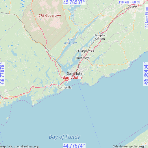
| Map corner | latitude | longitude |
|---|---|---|
| Upper-left | 45.76537°, | -66.77079° |
| Center: | 45.27271°, | -66.06766° |
| Lower-right: | 44.77574°, | -65.36454° |
| Map W x H: | 110×110 km | = 68.4×68.4mi |
| max Lat: | 73.03752° ⇑81.5% North |
| Saint John: | 45.27271° |
| min Lat: | ⇓18.5% South 42.05009° |
| min Long | Saint John | max Long |
| -139.43328° | -66.06766° | -52.70931° |
| W 87.9%⇐ | ⇒12.1% E |
Elevation
Elevation of Saint John is 5 m = 16 ft, and this is 249.4 m = 818 ft below average elevation for this country.
| Max E: |
1518 m = 4980 ft | 97.3% |
| Avg. | 254.4 m = 835 ft | |
| Saint John | 5 m = 16 ft | |
Min E: |
-2 m = -7 ft | 2.7% |
See also: Saint John elevation on elevation.city.
Geographical zone
Saint John is located in North temperate zone (between Tropic of Cancer and the Arctic Circle). Distance of this North polar circle is 2367.3 km =1471 mi to North.| Distance of | km | miles | from Saint John |
|---|---|---|---|
| North Pole | 4973.2 | 3090.2 | to North |
| Arctic Circle | 2367.3 | 1471 | to North |
| Tropic Cancer | 2427.9 | 1508.6 | to South |
| Equator | 5033.9 | 3127.9 | to South |


Nearby cities:
15 places around Saint John: (largest is in red/bold)
• Digby
76.3 km =47.4 mi,  161°
161°
• Fredericton
88.1 km =54.7 mi,  328°
328°
• Fundy Bay
80.4 km =50 mi,  222°
222°
• Greenwood
95.1 km =59.1 mi,  110°
110°
• Hampton
33 km =20.5 mi,  30°
30°
• Lincoln
80.4 km =50 mi, 330°
• Middleton
86.4 km =53.7 mi,  115°
115°
• New Maryland
82.1 km =51 mi, 325°
• Noonan
85.2 km =52.9 mi, 334°
• Oromocto
70.3 km =43.7 mi, 332°
• Pepper Creek
85.9 km =53.4 mi, 331°
• Saint Andrews
80.4 km =50 mi,  254°
254°
• Starlight Village
87.1 km =54.1 mi,  321°
321°
• Sussex
66.4 km =41.3 mi,  41°
41°
• Wells
17.5 km =10.9 mi, 40°
Sources, notices
• [Note1] Compared only with cities in Canada existing in our database
• [Src1] Map data: © OpenStreetMap contributors (CC-BY-SA)
• [Src2] Other city data from geonames.org with taken over terms of usage.
• [Src3] Geographical zone / Annual Mean Temperature by Robert A. Rohde @ Wikipedia
