Fundy Bay geodata
Fundy Bay (New Brunswick) is a populated place; located in Canada in America/Moncton (GMT-3) time zone. With population of 1,167 people, there are 965 cities with bigger population in this country. Compared to other cities in Canada, 85.9% of cities are located further ↑North; 86.4% of cities are located further ←West and 91.9% of cities have higher elevation than Fundy Bay. Note1


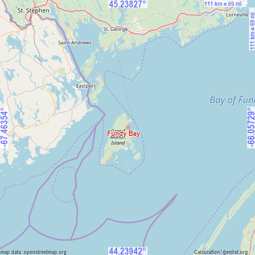
Fundy Bay GPS coordinates[2]
44° 44' 27.6" North, 66° 45' 37.476" West
| Map corner | latitude | longitude |
|---|---|---|
| Upper-left | 45.23827°, | -67.46354° |
| Center: | 44.741°, | -66.76041° |
| Lower-right: | 44.23942°, | -66.05729° |
| Map W x H: | 111.1×111.1 km | = 69×69mi |
| max Lat: | 73.03752° ⇑85.9% North |
| Fundy Bay: | 44.741° |
| min Lat: | ⇓14.1% South 42.05009° |
| min Long | Fundy Bay | max Long |
| -139.43328° | -66.76041° | -52.70931° |
| W 86.4%⇐ | ⇒13.6% E |
Elevation
Elevation of Fundy Bay is 12 m = 39 ft, and this is 242.4 m = 795 ft below average elevation for this country.
| Max E: |
1518 m = 4980 ft | 91.9% |
| Avg. | 254.4 m = 835 ft | |
| Fundy Bay | 12 m = 39 ft | |
Min E: |
-2 m = -7 ft | 8.1% |
See also: Canada elevation on elevation.city.
Geographical zone
Fundy Bay is located in North temperate zone (between Tropic of Cancer and the Arctic Circle). Distance of this Northern Tropic circle is 2368.8 km =1471.9 mi to South.| Distance of | km | miles | from Fundy Bay |
|---|---|---|---|
| North Pole | 5032.3 | 3126.9 | to North |
| Arctic Circle | 2426.4 | 1507.7 | to North |
| Tropic Cancer | 2368.8 | 1471.9 | to South |
| Equator | 4974.7 | 3091.1 | to South |


Nearby cities:
15 places around Fundy Bay: (largest is in red/bold)
• Carlisle Road
138.7 km =86.2 mi,  0°
0°
• Digby
80.3 km =49.9 mi,  99°
99°
• Fredericton
134.1 km =83.3 mi, 3°
• Hampton
112.8 km =70.1 mi,  39°
39°
• Lincoln
129.6 km =80.5 mi,  6°
6°
• Middleton
135.1 km =83.9 mi,  80°
80°
• New Maryland
126.8 km =78.8 mi, 3°
• Noonan
137.5 km =85.4 mi, 7°
• Oromocto
123.6 km =76.8 mi, 10°
• Pepper Creek
135.4 km =84.1 mi, 5°
• Saint Andrews
43.6 km =27.1 mi,  328°
328°
• Saint John
80.4 km =50 mi, 42°
• Starlight Village
127 km =78.9 mi,  359°
359°
• Wells
97.8 km =60.8 mi, 42°
• Yarmouth
113.2 km =70.3 mi,  153°
153°
Sources, notices
• [Note1] Compared only with cities in Canada existing in our database
• [Src1] Map data: © OpenStreetMap contributors (CC-BY-SA)
• [Src2] Other city data from geonames.org with taken over terms of usage.
• [Src3] Geographical zone / Annual Mean Temperature by Robert A. Rohde @ Wikipedia
