Starlight Village geodata
Starlight Village (New Brunswick) is a populated place; located in Canada in America/Moncton (GMT-3) time zone. With population of 2,127 people, there are 727 cities with bigger population in this country. Compared to other cities in Canada, 66.2% of cities are located further ↑North; 86.4% of cities are located further ←West and 61.7% of cities have higher elevation than Starlight Village. Note1


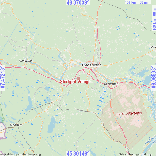
Starlight Village GPS coordinates[2]
45° 52' 59.088" North, 66° 46' 8.58" West
| Map corner | latitude | longitude |
|---|---|---|
| Upper-left | 46.37039°, | -67.47218° |
| Center: | 45.88308°, | -66.76905° |
| Lower-right: | 45.39146°, | -66.06593° |
| Map W x H: | 108.8×108.8 km | = 67.6×67.6mi |
| max Lat: | 73.03752° ⇑66.2% North |
| Starlight Village: | 45.88308° |
| min Lat: | ⇓33.8% South 42.05009° |
| min Long | Starlight Villa | max Long |
| -139.43328° | -66.76905° | -52.70931° |
| W 86.4%⇐ | ⇒13.6% E |
Elevation
Elevation of Starlight Village is 92 m = 302 ft, and this is 162.4 m = 533 ft below average elevation for this country.
| Max E: |
1518 m = 4980 ft | 61.7% |
| Avg. | 254.4 m = 835 ft | |
| Starlight Village | 92 m = 302 ft | |
Min E: |
-2 m = -7 ft | 38.3% |
See also: Canada elevation on elevation.city.
Geographical zone
Starlight Village is located in North temperate zone (between Tropic of Cancer and the Arctic Circle). Distance of this North polar circle is 2299.5 km =1428.8 mi to North.| Distance of | km | miles | from Starlight Village |
|---|---|---|---|
| North Pole | 4905.3 | 3048 | to North |
| Arctic Circle | 2299.5 | 1428.8 | to North |
| Tropic Cancer | 2495.8 | 1550.8 | to South |
| Equator | 5101.7 | 3170 | to South |


Nearby cities:
15 places around Starlight Village: (largest is in red/bold)
• Carlisle Road
11.7 km =7.3 mi,  3°
3°
• Florenceville-Bristol
90.2 km =56 mi,  313°
313°
• Fredericton
10.6 km =6.6 mi,  49°
49°
• Hampton
81.3 km =50.5 mi,  118°
118°
• Hartland
74 km =46 mi, 308°
• Keswick Ridge
15.7 km =9.8 mi,  326°
326°
• Lincoln
14.6 km =9.1 mi,  82°
82°
• Nackawic
38.6 km =24 mi,  289°
289°
• New Maryland
7.8 km =4.8 mi,  93°
93°
• Noonan
20.6 km =12.8 mi,  63°
63°
• Oromocto
23.1 km =14.4 mi,  103°
103°
• Pepper Creek
15.8 km =9.8 mi, 60°
• Saint Andrews
92.7 km =57.6 mi,  193°
193°
• Saint John
87.1 km =54.1 mi,  141°
141°
• Wells
85.4 km =53.1 mi,  129°
129°
Sources, notices
• [Note1] Compared only with cities in Canada existing in our database
• [Src1] Map data: © OpenStreetMap contributors (CC-BY-SA)
• [Src2] Other city data from geonames.org with taken over terms of usage.
• [Src3] Geographical zone / Annual Mean Temperature by Robert A. Rohde @ Wikipedia
