Volketswil / Volketswil (Dorf) geodata
Volketswil / Volketswil (Dorf) (Zurich) is a populated place; located in Switzerland in Europe/Zurich (GMT+2) time zone. With population of 2,723 people, there are 648 cities with bigger population in this country. Compared to other cities in Switzerland, 71.1% of cities are located further ↓South; 73.5% of cities are located further ←West and 53.7% of cities have higher elevation than Volketswil / Volketswil (Dorf). Note1
Current local time in Volketswil / Volketswil (Dorf):
08:52 AM, SaturdayDifference from your time zone: hours


Volketswil / Volketswil (Dorf) GPS coordinates[2]
47° 23' 24.576" North, 8° 41' 27.06" East
| Map corner | latitude | longitude |
|---|---|---|
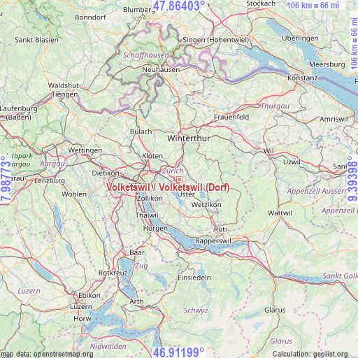
| Upper-left | 47.86403°, | 7.98773° |
| Center: | 47.39016°, | 8.69085° |
| Lower-right: | 46.91199°, | 9.39398° |
| Map W x H: | 105.9×105.9 km | = 65.8×65.8mi |
| max Lat: | 47.76737° ⇑28.9% North |
| Volketswil / Volketswil (Dorf): | 47.39016° |
| min Lat: | ⇓71.1% South 45.83203° |
| min Long | Volketswil / Vo | max Long |
| 5.97153° | 8.69085° | 10.44624° |
| W 73.5%⇐ | ⇒26.5% E |
Elevation
Elevation of Volketswil / Volketswil (Dorf) is 470 m = 1542 ft, and this is 88.2 m = 289 ft below average elevation for this country.
| Max E: |
1845 m = 6053 ft | 53.7% |
| Avg. | 558.2 m = 1831 ft | |
| Volketswil / Volketswil (Dorf) | 470 m = 1542 ft | |
Min E: |
197 m = 646 ft | 46.3% |
See also: Switzerland elevation on elevation.city.
Geographical zone
Volketswil / Volketswil (Dorf) is located in North temperate zone (between Tropic of Cancer and the Arctic Circle). Distance of this North polar circle is 2131.9 km =1324.7 mi to North.| Distance of | km | miles | from Volketswil / Volketswil (Dorf) |
|---|---|---|---|
| North Pole | 4737.8 | 2943.9 | to North |
| Arctic Circle | 2131.9 | 1324.7 | to North |
| Tropic Cancer | 2663.4 | 1655 | to South |
| Equator | 5269.3 | 3274.2 | to South |


Nearby cities:
15 places around Volketswil / Volketswil (Dorf): (largest is in red/bold)
• Greifensee
2.7 km =1.7 mi,  195°
195°
• Greifensee / Müllerwis / Seilerwis
2.3 km =1.4 mi, 197°
• Greifensee / Ocht
2.1 km =1.3 mi,  208°
208°
• Gutenswil
2.1 km =1.3 mi,  109°
109°
• Hegnau
1.6 km =1 mi,  278°
278°
• Hegnau / Alt-Hegnau
1.2 km =0.7 mi,  262°
262°
• Hegnau / Dammboden-Grindel
1.9 km =1.2 mi, 259°
• Hegnau / Im Zentrum
0.8 km =0.5 mi,  246°
246°
• Hegnau / Sunnebüel-Eich
0.9 km =0.6 mi,  286°
286°
• Kindhausen / Kindhausen (Dorf)
1.9 km =1.2 mi,  341°
341°
• Nänikon
2.3 km =1.4 mi,  183°
183°
• Nänikon / Nänikon (Dorfkern)
2.1 km =1.3 mi, 176°
• Schwerzenbach / Chimli
2.5 km =1.6 mi, 258°
• Schwerzenbach / Widacher
2.7 km =1.7 mi, 249°
• Zimikon / Rütiwies
2 km =1.2 mi, 249°
Sources, notices
• [Note1] Compared only with cities in Switzerland existing in our database
• [Src1] Map data: © OpenStreetMap contributors (CC-BY-SA)
• [Src2] Other city data from geonames.org with taken over terms of usage.
• [Src3] Geographical zone / Annual Mean Temperature by Robert A. Rohde @ Wikipedia
