Schwerzenbach / Chimli geodata
Schwerzenbach / Chimli (Zurich) is a section of populated place; located in Switzerland in Europe/Zurich (GMT+2) time zone. With population of 1,020 people, there are 1312 cities with bigger population in this country. Compared to other cities in Switzerland, 70.2% of cities are located further ↓South; 71.1% of cities are located further ←West and 65.3% of cities have higher elevation than Schwerzenbach / Chimli. Note1
Current local time in Schwerzenbach / Chimli:
07:40 AM, SaturdayDifference from your time zone: hours


Schwerzenbach / Chimli GPS coordinates[2]
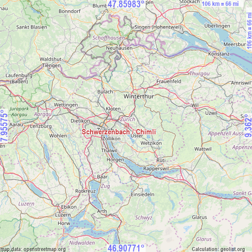
47° 23' 9.312" North, 8° 39' 31.968" East
| Map corner | latitude | longitude |
|---|---|---|
| Upper-left | 47.85983°, | 7.95575° |
| Center: | 47.38592°, | 8.65888° |
| Lower-right: | 46.90771°, | 9.362° |
| Map W x H: | 105.9×105.9 km | = 65.8×65.8mi |
| max Lat: | 47.76737° ⇑29.8% North |
| Schwerzenbach / Chimli: | 47.38592° |
| min Lat: | ⇓70.2% South 45.83203° |
| min Long | Schwerzenbach / | max Long |
| 5.97153° | 8.65888° | 10.44624° |
| W 71.1%⇐ | ⇒28.9% E |
Elevation
Elevation of Schwerzenbach / Chimli is 446 m = 1463 ft, and this is 112.2 m = 368 ft below average elevation for this country.
| Max E: |
1845 m = 6053 ft | 65.3% |
| Avg. | 558.2 m = 1831 ft | |
| Schwerzenbach / Chimli | 446 m = 1463 ft | |
Min E: |
197 m = 646 ft | 34.7% |
See also: Switzerland elevation on elevation.city.
Geographical zone
Schwerzenbach / Chimli is located in North temperate zone (between Tropic of Cancer and the Arctic Circle). Distance of this North polar circle is 2132.4 km =1325 mi to North.| Distance of | km | miles | from Schwerzenbach / Chimli |
|---|---|---|---|
| North Pole | 4738.2 | 2944.2 | to North |
| Arctic Circle | 2132.4 | 1325 | to North |
| Tropic Cancer | 2662.9 | 1654.6 | to South |
| Equator | 5268.8 | 3273.9 | to South |


Nearby cities:
15 places around Schwerzenbach / Chimli: (largest is in red/bold)
• Dübendorf / Frickenbuck
2.1 km =1.3 mi,  285°
285°
• Dübendorf / Gfenn
1.2 km =0.7 mi,  309°
309°
• Dübendorf / Sonnenberg
2.3 km =1.4 mi,  295°
295°
• Fällanden
2.2 km =1.4 mi,  223°
223°
• Greifensee / Ocht
2 km =1.2 mi,  135°
135°
• Hegnau
1.1 km =0.7 mi,  49°
49°
• Hegnau / Alt-Hegnau
1.2 km =0.7 mi,  75°
75°
• Hegnau / Dammboden-Grindel
0.6 km =0.4 mi, 76°
• Hegnau / Im Zentrum
1.7 km =1.1 mi, 84°
• Hegnau / Sunnebüel-Eich
1.7 km =1.1 mi,  64°
64°
• Schwerzenbach
0.4 km =0.2 mi,  196°
196°
• Schwerzenbach / Blatten
0.8 km =0.5 mi,  245°
245°
• Schwerzenbach / Chropfacher
0.3 km =0.2 mi,  214°
214°
• Schwerzenbach / Widacher
0.5 km =0.3 mi,  192°
192°
• Zimikon / Rütiwies
0.6 km =0.4 mi,  114°
114°
Sources, notices
• [Note1] Compared only with cities in Switzerland existing in our database
• [Src1] Map data: © OpenStreetMap contributors (CC-BY-SA)
• [Src2] Other city data from geonames.org with taken over terms of usage.
• [Src3] Geographical zone / Annual Mean Temperature by Robert A. Rohde @ Wikipedia
