Villnachern geodata
Villnachern (Aargau) is a populated place; located in Switzerland in Europe/Zurich (GMT+2) time zone. With population of 1,473 people, there are 1048 cities with bigger population in this country. Compared to other cities in Switzerland, 85% of cities are located further ↓South; 56.7% of cities are located further →East and 94.5% of cities have higher elevation than Villnachern. Note1


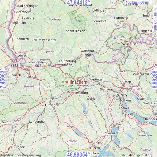
Villnachern GPS coordinates[2]
47° 28' 15.528" North, 8° 9' 35.1" East
| Map corner | latitude | longitude |
|---|---|---|
| Upper-left | 47.94412°, | 7.45663° |
| Center: | 47.47098°, | 8.15975° |
| Lower-right: | 46.99354°, | 8.86288° |
| Map W x H: | 105.7×105.7 km | = 65.7×65.7mi |
| max Lat: | 47.76737° ⇑15% North |
| Villnachern: | 47.47098° |
| min Lat: | ⇓85% South 45.83203° |
| min Long | Villnachern | max Long |
| 5.97153° | 8.15975° | 10.44624° |
| W 43.3%⇐ | ⇒56.7% E |
Elevation
Elevation of Villnachern is 366 m = 1201 ft, and this is 192.2 m = 631 ft below average elevation for this country.
| Max E: |
1845 m = 6053 ft | 94.5% |
| Avg. | 558.2 m = 1831 ft | |
| Villnachern | 366 m = 1201 ft | |
Min E: |
197 m = 646 ft | 5.5% |
See also: Switzerland elevation on elevation.city.
Geographical zone
Villnachern is located in North temperate zone (between Tropic of Cancer and the Arctic Circle). Distance of this North polar circle is 2122.9 km =1319.1 mi to North.| Distance of | km | miles | from Villnachern |
|---|---|---|---|
| North Pole | 4728.8 | 2938.3 | to North |
| Arctic Circle | 2122.9 | 1319.1 | to North |
| Tropic Cancer | 2672.4 | 1660.6 | to South |
| Equator | 5278.3 | 3279.8 | to South |


Nearby cities:
15 places around Villnachern: (largest is in red/bold)
• Birmenstorf
6.7 km =4.2 mi,  98°
98°
• Birr
5.5 km =3.4 mi,  137°
137°
• Brugg
3.8 km =2.4 mi,  73°
73°
• Bözen
6.3 km =3.9 mi,  295°
295°
• Effingen
4.7 km =2.9 mi,  294°
294°
• Gebenstorf
6.1 km =3.8 mi,  79°
79°
• Hausen
3.8 km =2.4 mi, 101°
• Lauffohr (Brugg)
6.4 km =4 mi,  57°
57°
• Schinznach Bad
2.4 km =1.5 mi,  164°
164°
• Schinznach Dorf
3.1 km =1.9 mi,  207°
207°
• Thalheim
6 km =3.7 mi,  228°
228°
• Veltheim
3.8 km =2.4 mi,  194°
194°
• Villigen
7.5 km =4.7 mi,  33°
33°
• Windisch
4.5 km =2.8 mi, 78°
• Zeihen
5.6 km =3.5 mi,  276°
276°
Sources, notices
• [Note1] Compared only with cities in Switzerland existing in our database
• [Src1] Map data: © OpenStreetMap contributors (CC-BY-SA)
• [Src2] Other city data from geonames.org with taken over terms of usage.
• [Src3] Geographical zone / Annual Mean Temperature by Robert A. Rohde @ Wikipedia
