Birmenstorf geodata
Birmenstorf (Aargau) is a populated place; located in Switzerland in Europe/Zurich (GMT+2) time zone. With population of 2,462 people, there are 702 cities with bigger population in this country. Compared to other cities in Switzerland, 83.9% of cities are located further ↓South; 54.3% of cities are located further →East and 91.5% of cities have higher elevation than Birmenstorf. Note1


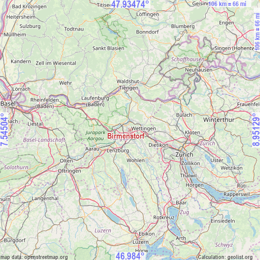
Birmenstorf GPS coordinates[2]
47° 27' 41.472" North, 8° 14' 53.376" East
| Map corner | latitude | longitude |
|---|---|---|
| Upper-left | 47.93474°, | 7.54504° |
| Center: | 47.46152°, | 8.24816° |
| Lower-right: | 46.984°, | 8.95129° |
| Map W x H: | 105.7×105.7 km | = 65.7×65.7mi |
| max Lat: | 47.76737° ⇑16.1% North |
| Birmenstorf: | 47.46152° |
| min Lat: | ⇓83.9% South 45.83203° |
| min Long | Birmenstorf | max Long |
| 5.97153° | 8.24816° | 10.44624° |
| W 45.7%⇐ | ⇒54.3% E |
Elevation
Elevation of Birmenstorf is 388 m = 1273 ft, and this is 170.2 m = 558 ft below average elevation for this country.
| Max E: |
1845 m = 6053 ft | 91.5% |
| Avg. | 558.2 m = 1831 ft | |
| Birmenstorf | 388 m = 1273 ft | |
Min E: |
197 m = 646 ft | 8.5% |
See also: Switzerland elevation on elevation.city.
Geographical zone
Birmenstorf is located in North temperate zone (between Tropic of Cancer and the Arctic Circle). Distance of this North polar circle is 2123.9 km =1319.7 mi to North.| Distance of | km | miles | from Birmenstorf |
|---|---|---|---|
| North Pole | 4729.8 | 2939 | to North |
| Arctic Circle | 2123.9 | 1319.7 | to North |
| Tropic Cancer | 2671.3 | 1659.9 | to South |
| Equator | 5277.2 | 3279.1 | to South |


Nearby cities:
15 places around Birmenstorf: (largest is in red/bold)
• Baden
4.5 km =2.8 mi,  73°
73°
• Birr
4.2 km =2.6 mi,  224°
224°
• Brugg
3.7 km =2.3 mi,  306°
306°
• Gebenstorf
2.3 km =1.4 mi,  343°
343°
• Hausen
2.9 km =1.8 mi,  275°
275°
• Lauffohr (Brugg)
4.6 km =2.9 mi, 344°
• Mellingen
5.1 km =3.2 mi,  158°
158°
• Neuenhof
6.1 km =3.8 mi,  102°
102°
• Niederrohrdorf
5.9 km =3.7 mi,  134°
134°
• Obersiggenthal
4.6 km =2.9 mi,  51°
51°
• Schinznach Bad
6.1 km =3.8 mi,  257°
257°
• Turgi
3.4 km =2.1 mi,  7°
7°
• Untersiggenthal
4.5 km =2.8 mi, 7°
• Wettingen
5.2 km =3.2 mi,  78°
78°
• Windisch
3 km =1.9 mi, 310°
Sources, notices
• [Note1] Compared only with cities in Switzerland existing in our database
• [Src1] Map data: © OpenStreetMap contributors (CC-BY-SA)
• [Src2] Other city data from geonames.org with taken over terms of usage.
• [Src3] Geographical zone / Annual Mean Temperature by Robert A. Rohde @ Wikipedia
