Reconvilier geodata
Reconvilier (Bern) is a populated place; located in Switzerland in Europe/Zurich (GMT+2) time zone. With population of 2,291 people, there are 745 cities with bigger population in this country. Compared to other cities in Switzerland, 50.1% of cities are located further ↓South; 81.5% of cities are located further →East and 84.9% of cities have lower elevation than Reconvilier. Note1


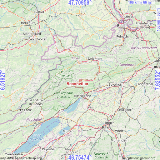
Reconvilier GPS coordinates[2]
47° 14' 3.516" North, 7° 13' 20.604" East
| Map corner | latitude | longitude |
|---|---|---|
| Upper-left | 47.70958°, | 6.51927° |
| Center: | 47.23431°, | 7.22239° |
| Lower-right: | 46.75474°, | 7.92552° |
| Map W x H: | 106.2×106.2 km | = 66×66mi |
| max Lat: | 47.76737° ⇑49.9% North |
| Reconvilier: | 47.23431° |
| min Lat: | ⇓50.1% South 45.83203° |
| min Long | Reconvilier | max Long |
| 5.97153° | 7.22239° | 10.44624° |
| W 18.5%⇐ | ⇒81.5% E |
Elevation
Elevation of Reconvilier is 734 m = 2408 ft, and this is 175.8 m = 577 ft above average elevation for this country.
| Max E: |
1845 m = 6053 ft | 15.1% |
| Reconvilier | 734 m 2408 ft | |
| Avg. | 558.2 m = 1831 ft | |
Min E: |
197 m = 646 ft | 84.9% |
See also: Switzerland elevation on elevation.city.
Geographical zone
Reconvilier is located in North temperate zone (between Tropic of Cancer and the Arctic Circle). Distance of this North polar circle is 2149.2 km =1335.5 mi to North.| Distance of | km | miles | from Reconvilier |
|---|---|---|---|
| North Pole | 4755.1 | 2954.7 | to North |
| Arctic Circle | 2149.2 | 1335.5 | to North |
| Tropic Cancer | 2646 | 1644.1 | to South |
| Equator | 5252 | 3263.4 | to South |


Nearby cities:
15 places around Reconvilier: (largest is in red/bold)
• Biel/Bienne
11 km =6.8 mi,  170°
170°
• Bévilard
4.6 km =2.9 mi,  86°
86°
• Corgémont
7.3 km =4.5 mi,  232°
232°
• Court
8.6 km =5.3 mi, 86°
• Evilard
9.4 km =5.8 mi, 172°
• Lajoux
8.1 km =5 mi,  307°
307°
• Magglingen
10.6 km =6.6 mi,  183°
183°
• Malleray
3.8 km =2.4 mi,  83°
83°
• Orvin
8.2 km =5.1 mi, 184°
• Perrefitte
10.1 km =6.3 mi,  62°
62°
• Pieterlen
10.9 km =6.8 mi,  127°
127°
• Péry
4.9 km =3 mi,  155°
155°
• Saicourt
1.6 km =1 mi, 309°
• Tavannes
2.4 km =1.5 mi, 231°
• Tramelan
9.1 km =5.7 mi,  262°
262°
Sources, notices
• [Note1] Compared only with cities in Switzerland existing in our database
• [Src1] Map data: © OpenStreetMap contributors (CC-BY-SA)
• [Src2] Other city data from geonames.org with taken over terms of usage.
• [Src3] Geographical zone / Annual Mean Temperature by Robert A. Rohde @ Wikipedia
