Pieterlen geodata
Pieterlen (Bern) is a populated place; located in Switzerland in Europe/Zurich (GMT+2) time zone. With population of 3,317 people, there are 525 cities with bigger population in this country. Compared to other cities in Switzerland, 54.6% of cities are located further ↑North; 79.1% of cities are located further →East and 69.1% of cities have higher elevation than Pieterlen. Note1


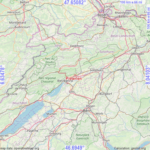
Pieterlen GPS coordinates[2]
47° 10' 30.036" North, 7° 20' 16.476" East
| Map corner | latitude | longitude |
|---|---|---|
| Upper-left | 47.65082°, | 6.63478° |
| Center: | 47.17501°, | 7.33791° |
| Lower-right: | 46.6949°, | 8.04103° |
| Map W x H: | 106.3×106.3 km | = 66.1×66.1mi |
| max Lat: | 47.76737° ⇑54.6% North |
| Pieterlen: | 47.17501° |
| min Lat: | ⇓45.4% South 45.83203° |
| min Long | Pieterlen | max Long |
| 5.97153° | 7.33791° | 10.44624° |
| W 20.9%⇐ | ⇒79.1% E |
Elevation
Elevation of Pieterlen is 440 m = 1444 ft, and this is 118.2 m = 388 ft below average elevation for this country.
| Max E: |
1845 m = 6053 ft | 69.1% |
| Avg. | 558.2 m = 1831 ft | |
| Pieterlen | 440 m = 1444 ft | |
Min E: |
197 m = 646 ft | 30.9% |
See also: Switzerland elevation on elevation.city.
Geographical zone
Pieterlen is located in North temperate zone (between Tropic of Cancer and the Arctic Circle). Distance of this North polar circle is 2155.8 km =1339.6 mi to North.| Distance of | km | miles | from Pieterlen |
|---|---|---|---|
| North Pole | 4761.7 | 2958.8 | to North |
| Arctic Circle | 2155.8 | 1339.6 | to North |
| Tropic Cancer | 2639.5 | 1640.1 | to South |
| Equator | 5245.4 | 3259.3 | to South |


Nearby cities:
15 places around Pieterlen: (largest is in red/bold)
• Arch
7.1 km =4.4 mi,  98°
98°
• Bettlach
7.1 km =4.4 mi,  66°
66°
• Biel/Bienne
8.1 km =5 mi,  238°
238°
• Brügg
7.2 km =4.5 mi,  218°
218°
• Bévilard
8 km =5 mi,  329°
329°
• Büren an der Aare
4.6 km =2.9 mi,  146°
146°
• Court
7.2 km =4.5 mi,  359°
359°
• Evilard
8 km =5 mi,  249°
249°
• Grenchen
4.8 km =3 mi, 66°
• Lengnau
2.4 km =1.5 mi, 72°
• Malleray
8.6 km =5.3 mi, 325°
• Meinisberg
1.9 km =1.2 mi,  155°
155°
• Orpund
4.6 km =2.9 mi,  209°
209°
• Péry
7 km =4.3 mi,  287°
287°
• Schnottwil
8.2 km =5.1 mi, 149°
Sources, notices
• [Note1] Compared only with cities in Switzerland existing in our database
• [Src1] Map data: © OpenStreetMap contributors (CC-BY-SA)
• [Src2] Other city data from geonames.org with taken over terms of usage.
• [Src3] Geographical zone / Annual Mean Temperature by Robert A. Rohde @ Wikipedia
