Bévilard geodata
Bévilard (Bern) is a populated place; located in Switzerland in Europe/Zurich (GMT+2) time zone. With population of 1,736 people, there are 929 cities with bigger population in this country. Compared to other cities in Switzerland, 50.4% of cities are located further ↓South; 79.9% of cities are located further →East and 82.3% of cities have lower elevation than Bévilard. Note1


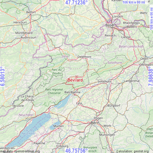
Bévilard GPS coordinates[2]
47° 14' 13.596" North, 7° 16' 59.7" East
| Map corner | latitude | longitude |
|---|---|---|
| Upper-left | 47.71236°, | 6.58013° |
| Center: | 47.23711°, | 7.28325° |
| Lower-right: | 46.75756°, | 7.98638° |
| Map W x H: | 106.2×106.2 km | = 66×66mi |
| max Lat: | 47.76737° ⇑49.6% North |
| Bévilard: | 47.23711° |
| min Lat: | ⇓50.4% South 45.83203° |
| min Long | Bévilard | max Long |
| 5.97153° | 7.28325° | 10.44624° |
| W 20.1%⇐ | ⇒79.9% E |
Elevation
Elevation of Bévilard is 696 m = 2283 ft, and this is 137.8 m = 452 ft above average elevation for this country.
| Max E: |
1845 m = 6053 ft | 17.7% |
| Bévilard | 696 m 2283 ft | |
| Avg. | 558.2 m = 1831 ft | |
Min E: |
197 m = 646 ft | 82.3% |
See also: Switzerland elevation on elevation.city.
Geographical zone
Bévilard is located in North temperate zone (between Tropic of Cancer and the Arctic Circle). Distance of this North polar circle is 2148.9 km =1335.3 mi to North.| Distance of | km | miles | from Bévilard |
|---|---|---|---|
| North Pole | 4754.8 | 2954.5 | to North |
| Arctic Circle | 2148.9 | 1335.3 | to North |
| Tropic Cancer | 2646.4 | 1644.4 | to South |
| Equator | 5252.3 | 3263.6 | to South |


Nearby cities:
15 places around Bévilard: (largest is in red/bold)
• Courfaivre
10.8 km =6.7 mi,  359°
359°
• Court
4 km =2.5 mi,  86°
86°
• Evilard
10.2 km =6.3 mi,  199°
199°
• Grenchen
9.9 km =6.2 mi,  120°
120°
• Lengnau
8.9 km =5.5 mi,  133°
133°
• Malleray
0.8 km =0.5 mi,  280°
280°
• Meinisberg
9.9 km =6.2 mi,  150°
150°
• Moutier
8 km =5 mi,  54°
54°
• Orvin
10 km =6.2 mi,  211°
211°
• Perrefitte
6.1 km =3.8 mi, 45°
• Pieterlen
8 km =5 mi, 149°
• Péry
5.4 km =3.4 mi, 208°
• Reconvilier
4.6 km =2.9 mi,  266°
266°
• Saicourt
5.9 km =3.7 mi, 276°
• Tavannes
6.7 km =4.2 mi,  254°
254°
Sources, notices
• [Note1] Compared only with cities in Switzerland existing in our database
• [Src1] Map data: © OpenStreetMap contributors (CC-BY-SA)
• [Src2] Other city data from geonames.org with taken over terms of usage.
• [Src3] Geographical zone / Annual Mean Temperature by Robert A. Rohde @ Wikipedia
