Plan-les-Ouates geodata
Plan-les-Ouates (Geneva) is a populated place; located in Switzerland in Europe/Zurich (GMT+2) time zone. With population of 10,540 people, there are 131 cities with bigger population in this country. Compared to other cities in Switzerland, 96.1% of cities are located further ↑North; 99.3% of cities are located further →East and 86.2% of cities have higher elevation than Plan-les-Ouates. Note1


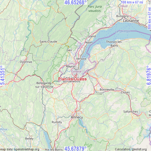
Plan-les-Ouates GPS coordinates[2]
46° 10' 4.404" North, 6° 6' 59.904" East
| Map corner | latitude | longitude |
|---|---|---|
| Upper-left | 46.65268°, | 5.41351° |
| Center: | 46.16789°, | 6.11664° |
| Lower-right: | 45.67879°, | 6.81976° |
| Map W x H: | 108.3×108.3 km | = 67.3×67.3mi |
| max Lat: | 47.76737° ⇑96.1% North |
| Plan-les-Ouates: | 46.16789° |
| min Lat: | ⇓3.9% South 45.83203° |
| min Long | Plan-les-Ouates | max Long |
| 5.97153° | 6.11664° | 10.44624° |
| W 0.7%⇐ | ⇒99.3% E |
Elevation
Elevation of Plan-les-Ouates is 407 m = 1335 ft, and this is 151.2 m = 496 ft below average elevation for this country.
| Max E: |
1845 m = 6053 ft | 86.2% |
| Avg. | 558.2 m = 1831 ft | |
| Plan-les-Ouates | 407 m = 1335 ft | |
Min E: |
197 m = 646 ft | 13.8% |
See also: Switzerland elevation on elevation.city.
Geographical zone
Plan-les-Ouates is located in North temperate zone (between Tropic of Cancer and the Arctic Circle). Distance of this North polar circle is 2267.8 km =1409.1 mi to North.| Distance of | km | miles | from Plan-les-Ouates |
|---|---|---|---|
| North Pole | 4873.7 | 3028.4 | to North |
| Arctic Circle | 2267.8 | 1409.1 | to North |
| Tropic Cancer | 2527.5 | 1570.5 | to South |
| Equator | 5133.4 | 3189.7 | to South |


Nearby cities:
15 places around Plan-les-Ouates: (largest is in red/bold)
• Aire-la-Ville
6.2 km =3.9 mi,  293°
293°
• Bernex
3.3 km =2.1 mi, 286°
• Carouge
2.3 km =1.4 mi,  50°
50°
• Chêne-Bougeries
6.4 km =4 mi,  57°
57°
• Chêne-Bourg
6.7 km =4.2 mi, 62°
• Confignon
2.6 km =1.6 mi,  283°
283°
• Genève
4.4 km =2.7 mi,  30°
30°
• Lancy
2.4 km =1.5 mi,  355°
355°
• Les Avanchets
6 km =3.7 mi,  353°
353°
• Onex
2.1 km =1.3 mi,  328°
328°
• Soral
6.3 km =3.9 mi,  244°
244°
• Thônex
6.7 km =4.2 mi,  70°
70°
• Troinex
2.4 km =1.5 mi,  102°
102°
• Vernier
6 km =3.7 mi,  335°
335°
• Veyrier
5.2 km =3.2 mi,  91°
91°
Sources, notices
• [Note1] Compared only with cities in Switzerland existing in our database
• [Src1] Map data: © OpenStreetMap contributors (CC-BY-SA)
• [Src2] Other city data from geonames.org with taken over terms of usage.
• [Src3] Geographical zone / Annual Mean Temperature by Robert A. Rohde @ Wikipedia
