Chêne-Bourg geodata
Chêne-Bourg (Geneva) is a populated place; located in Switzerland in Europe/Zurich (GMT+2) time zone. With population of 7,959 people, there are 201 cities with bigger population in this country. Compared to other cities in Switzerland, 94.3% of cities are located further ↑North; 98.4% of cities are located further →East and 79.7% of cities have higher elevation than Chêne-Bourg. Note1


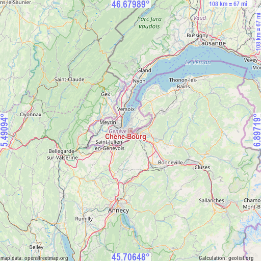
Chêne-Bourg GPS coordinates[2]
46° 11' 43.224" North, 6° 11' 38.616" East
| Map corner | latitude | longitude |
|---|---|---|
| Upper-left | 46.67989°, | 5.49094° |
| Center: | 46.19534°, | 6.19406° |
| Lower-right: | 45.70648°, | 6.89719° |
| Map W x H: | 108.2×108.2 km | = 67.2×67.2mi |
| max Lat: | 47.76737° ⇑94.3% North |
| Chêne-Bourg: | 46.19534° |
| min Lat: | ⇓5.7% South 45.83203° |
| min Long | Chêne-Bourg | max Long |
| 5.97153° | 6.19406° | 10.44624° |
| W 1.6%⇐ | ⇒98.4% E |
Elevation
Elevation of Chêne-Bourg is 422 m = 1385 ft, and this is 136.2 m = 447 ft below average elevation for this country.
| Max E: |
1845 m = 6053 ft | 79.7% |
| Avg. | 558.2 m = 1831 ft | |
| Chêne-Bourg | 422 m = 1385 ft | |
Min E: |
197 m = 646 ft | 20.3% |
See also: Switzerland elevation on elevation.city.
Geographical zone
Chêne-Bourg is located in North temperate zone (between Tropic of Cancer and the Arctic Circle). Distance of this North polar circle is 2264.7 km =1407.2 mi to North.| Distance of | km | miles | from Chêne-Bourg |
|---|---|---|---|
| North Pole | 4870.6 | 3026.4 | to North |
| Arctic Circle | 2264.7 | 1407.2 | to North |
| Tropic Cancer | 2530.5 | 1572.4 | to South |
| Equator | 5136.4 | 3191.6 | to South |


Nearby cities:
15 places around Chêne-Bourg: (largest is in red/bold)
• Carouge
4.5 km =2.8 mi,  249°
249°
• Chêne-Bougeries
0.7 km =0.4 mi,  300°
300°
• Genève
3.8 km =2.4 mi,  281°
281°
• Jussy
7.2 km =4.5 mi,  51°
51°
• Lancy
6.2 km =3.9 mi,  264°
264°
• Le Grand-Saconnex
6.9 km =4.3 mi,  305°
305°
• Meinier
6.5 km =4 mi,  28°
28°
• Onex
7.2 km =4.5 mi, 259°
• Plan-les-Ouates
6.7 km =4.2 mi,  242°
242°
• Presinge
5.4 km =3.4 mi,  60°
60°
• Puplinge
3.3 km =2.1 mi, 59°
• Thônex
0.9 km =0.6 mi,  154°
154°
• Troinex
5.1 km =3.2 mi,  225°
225°
• Vandœuvres
3 km =1.9 mi,  12°
12°
• Veyrier
3.2 km =2 mi,  193°
193°
Sources, notices
• [Note1] Compared only with cities in Switzerland existing in our database
• [Src1] Map data: © OpenStreetMap contributors (CC-BY-SA)
• [Src2] Other city data from geonames.org with taken over terms of usage.
• [Src3] Geographical zone / Annual Mean Temperature by Robert A. Rohde @ Wikipedia
