Oberembrach geodata
Oberembrach (Zurich) is a populated place; located in Switzerland in Europe/Zurich (GMT+2) time zone. With population of 694 people, there are 1606 cities with bigger population in this country. Compared to other cities in Switzerland, 87.2% of cities are located further ↓South; 68% of cities are located further ←West and 57.9% of cities have higher elevation than Oberembrach. Note1


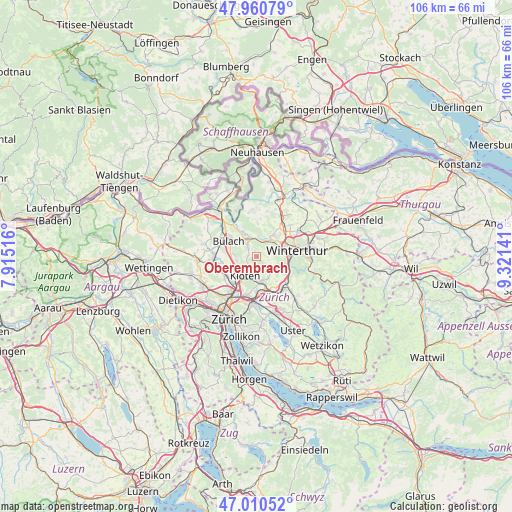
Oberembrach GPS coordinates[2]
47° 29' 16.08" North, 8° 37' 5.808" East
| Map corner | latitude | longitude |
|---|---|---|
| Upper-left | 47.96079°, | 7.91516° |
| Center: | 47.4878°, | 8.61828° |
| Lower-right: | 47.01052°, | 9.32141° |
| Map W x H: | 105.7×105.7 km | = 65.7×65.7mi |
| max Lat: | 47.76737° ⇑12.8% North |
| Oberembrach: | 47.4878° |
| min Lat: | ⇓87.2% South 45.83203° |
| min Long | Oberembrach | max Long |
| 5.97153° | 8.61828° | 10.44624° |
| W 68%⇐ | ⇒32% E |
Elevation
Elevation of Oberembrach is 459 m = 1506 ft, and this is 99.2 m = 325 ft below average elevation for this country.
| Max E: |
1845 m = 6053 ft | 57.9% |
| Avg. | 558.2 m = 1831 ft | |
| Oberembrach | 459 m = 1506 ft | |
Min E: |
197 m = 646 ft | 42.1% |
See also: Switzerland elevation on elevation.city.
Geographical zone
Oberembrach is located in North temperate zone (between Tropic of Cancer and the Arctic Circle). Distance of this North polar circle is 2121 km =1317.9 mi to North.| Distance of | km | miles | from Oberembrach |
|---|---|---|---|
| North Pole | 4726.9 | 2937.2 | to North |
| Arctic Circle | 2121 | 1317.9 | to North |
| Tropic Cancer | 2674.2 | 1661.7 | to South |
| Equator | 5280.1 | 3280.9 | to South |


Nearby cities:
15 places around Oberembrach: (largest is in red/bold)
• Birchwil
3.9 km =2.4 mi,  161°
161°
• Brütten
4.6 km =2.9 mi,  110°
110°
• Embrach
2.7 km =1.7 mi,  317°
317°
• Embrach / Bächli
3.2 km =2 mi,  327°
327°
• Embrach / Ebnet
4 km =2.5 mi, 323°
• Embrach / Embrach (Dorfkern)
2.5 km =1.6 mi, 315°
• Embrach / Kellersacker
3.6 km =2.2 mi, 325°
• Embrach / Wildbach
3.4 km =2.1 mi, 322°
• Kloten
4.8 km =3 mi,  211°
211°
• Kloten / Freienberg (Chanzler-Chlini Chaseren)
3.7 km =2.3 mi,  228°
228°
• Kloten / Geissberg
4.3 km =2.7 mi, 209°
• Kloten / Horainli
4.6 km =2.9 mi,  215°
215°
• Kloten / Hostrass
4.3 km =2.7 mi,  204°
204°
• Kloten / Kloten (Zentrum)
4.7 km =2.9 mi, 210°
• Pfungen
3.4 km =2.1 mi,  31°
31°
Sources, notices
• [Note1] Compared only with cities in Switzerland existing in our database
• [Src1] Map data: © OpenStreetMap contributors (CC-BY-SA)
• [Src2] Other city data from geonames.org with taken over terms of usage.
• [Src3] Geographical zone / Annual Mean Temperature by Robert A. Rohde @ Wikipedia
