Brütten geodata
Brütten (Zurich) is a populated place; located in Switzerland in Europe/Zurich (GMT+2) time zone. With population of 1,556 people, there are 1006 cities with bigger population in this country. Compared to other cities in Switzerland, 85.2% of cities are located further ↓South; 72.1% of cities are located further ←West and 75.5% of cities have lower elevation than Brütten. Note1


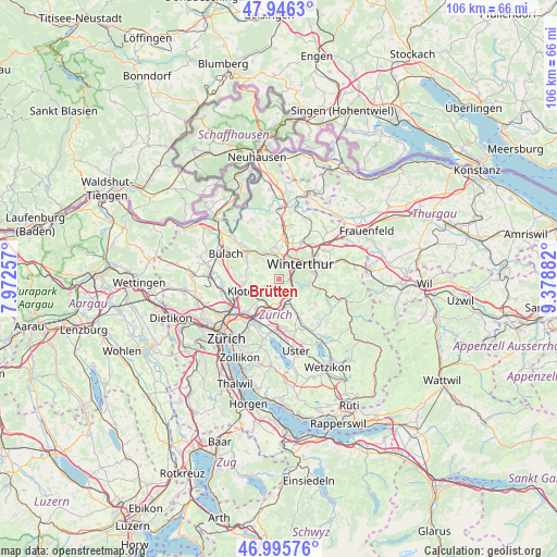
Brütten GPS coordinates[2]
47° 28' 23.448" North, 8° 40' 32.484" East
| Map corner | latitude | longitude |
|---|---|---|
| Upper-left | 47.9463°, | 7.97257° |
| Center: | 47.47318°, | 8.67569° |
| Lower-right: | 46.99576°, | 9.37882° |
| Map W x H: | 105.7×105.7 km | = 65.7×65.7mi |
| max Lat: | 47.76737° ⇑14.8% North |
| Brütten: | 47.47318° |
| min Lat: | ⇓85.2% South 45.83203° |
| min Long | Brütten | max Long |
| 5.97153° | 8.67569° | 10.44624° |
| W 72.1%⇐ | ⇒27.9% E |
Elevation
Elevation of Brütten is 622 m = 2041 ft, and this is 63.8 m = 209 ft above average elevation for this country.
| Max E: |
1845 m = 6053 ft | 24.5% |
| Brütten | 622 m 2041 ft | |
| Avg. | 558.2 m = 1831 ft | |
Min E: |
197 m = 646 ft | 75.5% |
See also: Switzerland elevation on elevation.city.
Geographical zone
Brütten is located in North temperate zone (between Tropic of Cancer and the Arctic Circle). Distance of this North polar circle is 2122.7 km =1319 mi to North.| Distance of | km | miles | from Brütten |
|---|---|---|---|
| North Pole | 4728.5 | 2938.2 | to North |
| Arctic Circle | 2122.7 | 1319 | to North |
| Tropic Cancer | 2672.6 | 1660.7 | to South |
| Equator | 5278.5 | 3279.9 | to South |


Nearby cities:
15 places around Brütten: (largest is in red/bold)
• Birchwil
3.7 km =2.3 mi,  235°
235°
• Grafstal
3.8 km =2.4 mi,  151°
151°
• Lindau
3.4 km =2.1 mi,  182°
182°
• Nürensdorf
3.4 km =2.1 mi,  215°
215°
• Stadt Winterthur (Kreis 1)
4.1 km =2.5 mi,  53°
53°
• Stadt Winterthur (Kreis 1) / Brühlberg
3.9 km =2.4 mi, 45°
• Stadt Winterthur (Kreis 1) / Tössfeld
3.7 km =2.3 mi, 52°
• Töss (Kreis 4)
2.1 km =1.3 mi,  72°
72°
• Töss (Kreis 4) / Eichliacker
2.9 km =1.8 mi,  56°
56°
• Töss (Kreis 4) / Schlosstal
3 km =1.9 mi,  42°
42°
• Töss (Kreis 4) / Steig
2 km =1.2 mi,  87°
87°
• Töss (Kreis 4) / Vorder-Dättnau
1.9 km =1.2 mi, 62°
• Winterberg
2.3 km =1.4 mi,  142°
142°
• Wülflingen (Kreis 6) / Niederfeld
4 km =2.5 mi,  4°
4°
• Wülflingen (Kreis 6) / Oberfeld
3.3 km =2.1 mi,  31°
31°
Sources, notices
• [Note1] Compared only with cities in Switzerland existing in our database
• [Src1] Map data: © OpenStreetMap contributors (CC-BY-SA)
• [Src2] Other city data from geonames.org with taken over terms of usage.
• [Src3] Geographical zone / Annual Mean Temperature by Robert A. Rohde @ Wikipedia
