Kandergrund geodata
Kandergrund (Bern) is a populated place; located in Switzerland in Europe/Zurich (GMT+2) time zone. With population of 995 people, there are 1332 cities with bigger population in this country. Compared to other cities in Switzerland, 83.4% of cities are located further ↑North; 69.6% of cities are located further →East and 89.2% of cities have lower elevation than Kandergrund. Note1
Administrative division(s):
- Level 1: Bern
- Level 2: Frutigen-Niedersimmental District
- Level 3: Kandergrund


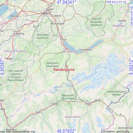
Kandergrund GPS coordinates[2]
46° 33' 43.632" North, 7° 39' 32.4" East
| Map corner | latitude | longitude |
|---|---|---|
| Upper-left | 47.04341°, | 6.95587° |
| Center: | 46.56212°, | 7.659° |
| Lower-right: | 46.07652°, | 8.36212° |
| Map W x H: | 107.5×107.5 km | = 66.8×66.8mi |
| max Lat: | 47.76737° ⇑83.4% North |
| Kandergrund: | 46.56212° |
| min Lat: | ⇓16.6% South 45.83203° |
| min Long | Kandergrund | max Long |
| 5.97153° | 7.659° | 10.44624° |
| W 30.4%⇐ | ⇒69.6% E |
Elevation
Elevation of Kandergrund is 808 m = 2651 ft, and this is 249.8 m = 820 ft above average elevation for this country.
| Max E: |
1845 m = 6053 ft | 10.8% |
| Kandergrund | 808 m 2651 ft | |
| Avg. | 558.2 m = 1831 ft | |
Min E: |
197 m = 646 ft | 89.2% |
See also: Switzerland elevation on elevation.city.
Geographical zone
Kandergrund is located in North temperate zone (between Tropic of Cancer and the Arctic Circle). Distance of this North polar circle is 2224 km =1381.9 mi to North.| Distance of | km | miles | from Kandergrund |
|---|---|---|---|
| North Pole | 4829.8 | 3001.1 | to North |
| Arctic Circle | 2224 | 1381.9 | to North |
| Tropic Cancer | 2571.3 | 1597.7 | to South |
| Equator | 5177.2 | 3217 | to South |


Nearby cities:
15 places around Kandergrund: (largest is in red/bold)
• Adelboden
10.9 km =6.8 mi,  223°
223°
• Aeschi b. Spiez
11.1 km =6.9 mi,  14°
14°
• Beatenberg
18.4 km =11.4 mi,  34°
34°
• Diemtigen
12.1 km =7.5 mi,  323°
323°
• Därligen
15.9 km =9.9 mi,  45°
45°
• Därstetten
16.8 km =10.4 mi,  310°
310°
• Erlenbach im Simmental
13.5 km =8.4 mi, 323°
• Frutigen
2.9 km =1.8 mi,  345°
345°
• Kandersteg
7.6 km =4.7 mi,  171°
171°
• Krattigen
12.2 km =7.6 mi, 25°
• Leissigen
13.6 km =8.5 mi,  40°
40°
• Reutigen
14.9 km =9.3 mi, 348°
• Sigriswil
17.7 km =11 mi, 13°
• Spiez
13.9 km =8.6 mi, 10°
• Wimmis
12.7 km =7.9 mi, 353°
Sources, notices
• [Note1] Compared only with cities in Switzerland existing in our database
• [Src1] Map data: © OpenStreetMap contributors (CC-BY-SA)
• [Src2] Other city data from geonames.org with taken over terms of usage.
• [Src3] Geographical zone / Annual Mean Temperature by Robert A. Rohde @ Wikipedia
