Müntschemier geodata
Müntschemier (Bern) is a populated place; located in Switzerland in Europe/Zurich (GMT+2) time zone. With population of 1,333 people, there are 1113 cities with bigger population in this country. Compared to other cities in Switzerland, 64.7% of cities are located further ↑North; 83.5% of cities are located further →East and 69.1% of cities have higher elevation than Müntschemier. Note1


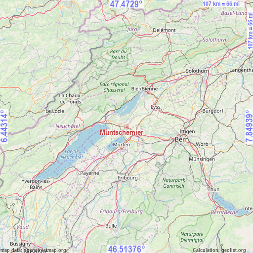
Müntschemier GPS coordinates[2]
46° 59' 43.728" North, 7° 8' 46.536" East
| Map corner | latitude | longitude |
|---|---|---|
| Upper-left | 47.4729°, | 6.44314° |
| Center: | 46.99548°, | 7.14626° |
| Lower-right: | 46.51376°, | 7.84939° |
| Map W x H: | 106.6×106.6 km | = 66.2×66.2mi |
| max Lat: | 47.76737° ⇑64.7% North |
| Müntschemier: | 46.99548° |
| min Lat: | ⇓35.3% South 45.83203° |
| min Long | Müntschemier | max Long |
| 5.97153° | 7.14626° | 10.44624° |
| W 16.5%⇐ | ⇒83.5% E |
Elevation
Elevation of Müntschemier is 440 m = 1444 ft, and this is 118.2 m = 388 ft below average elevation for this country.
| Max E: |
1845 m = 6053 ft | 69.1% |
| Avg. | 558.2 m = 1831 ft | |
| Müntschemier | 440 m = 1444 ft | |
Min E: |
197 m = 646 ft | 30.9% |
See also: Switzerland elevation on elevation.city.
Geographical zone
Müntschemier is located in North temperate zone (between Tropic of Cancer and the Arctic Circle). Distance of this North polar circle is 2175.8 km =1352 mi to North.| Distance of | km | miles | from Müntschemier |
|---|---|---|---|
| North Pole | 4781.7 | 2971.2 | to North |
| Arctic Circle | 2175.8 | 1352 | to North |
| Tropic Cancer | 2619.5 | 1627.7 | to South |
| Equator | 5225.4 | 3246.9 | to South |


Nearby cities:
15 places around Müntschemier: (largest is in red/bold)
• Bas-Vully
4.5 km =2.8 mi,  214°
214°
• Brüttelen
3 km =1.9 mi,  2°
2°
• Erlach
6.4 km =4 mi,  324°
324°
• Ferenbalm
7.2 km =4.5 mi,  136°
136°
• Galmiz
5.3 km =3.3 mi,  170°
170°
• Gals
8 km =5 mi,  297°
297°
• Gampelen
7 km =4.3 mi,  285°
285°
• Ins
3.3 km =2.1 mi, 290°
• Kallnach
7.3 km =4.5 mi,  67°
67°
• Kerzers
4.3 km =2.7 mi,  120°
120°
• La Neuveville
8.7 km =5.4 mi,  334°
334°
• Le Landeron
8.9 km =5.5 mi, 320°
• Murten/Morat
7.8 km =4.8 mi,  196°
196°
• Siselen
5.2 km =3.2 mi,  38°
38°
• Täuffelen
8.8 km =5.5 mi,  26°
26°
Sources, notices
• [Note1] Compared only with cities in Switzerland existing in our database
• [Src1] Map data: © OpenStreetMap contributors (CC-BY-SA)
• [Src2] Other city data from geonames.org with taken over terms of usage.
• [Src3] Geographical zone / Annual Mean Temperature by Robert A. Rohde @ Wikipedia
