Corminboeuf geodata
Corminboeuf (Fribourg) is a populated place; located in Switzerland in Europe/Zurich (GMT+2) time zone. With population of 1,702 people, there are 944 cities with bigger population in this country. Compared to other cities in Switzerland, 74% of cities are located further ↑North; 84.8% of cities are located further →East and 78.7% of cities have lower elevation than Corminboeuf. Note1


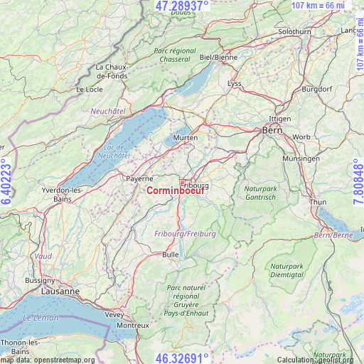
Corminboeuf GPS coordinates[2]
46° 48' 37.044" North, 7° 6' 19.26" East
| Map corner | latitude | longitude |
|---|---|---|
| Upper-left | 47.28937°, | 6.40223° |
| Center: | 46.81029°, | 7.10535° |
| Lower-right: | 46.32691°, | 7.80848° |
| Map W x H: | 107×107 km | = 66.5×66.5mi |
| max Lat: | 47.76737° ⇑74% North |
| Corminboeuf: | 46.81029° |
| min Lat: | ⇓26% South 45.83203° |
| min Long | Corminboeuf | max Long |
| 5.97153° | 7.10535° | 10.44624° |
| W 15.2%⇐ | ⇒84.8% E |
Elevation
Elevation of Corminboeuf is 646 m = 2119 ft, and this is 87.8 m = 288 ft above average elevation for this country.
| Max E: |
1845 m = 6053 ft | 21.3% |
| Corminboeuf | 646 m 2119 ft | |
| Avg. | 558.2 m = 1831 ft | |
Min E: |
197 m = 646 ft | 78.7% |
See also: Switzerland elevation on elevation.city.
Geographical zone
Corminboeuf is located in North temperate zone (between Tropic of Cancer and the Arctic Circle). Distance of this North polar circle is 2196.4 km =1364.8 mi to North.| Distance of | km | miles | from Corminboeuf |
|---|---|---|---|
| North Pole | 4802.2 | 2983.9 | to North |
| Arctic Circle | 2196.4 | 1364.8 | to North |
| Tropic Cancer | 2598.9 | 1614.9 | to South |
| Equator | 5204.8 | 3234.1 | to South |


Nearby cities:
15 places around Corminboeuf: (largest is in red/bold)
• Arconciel
7.1 km =4.4 mi,  170°
170°
• Avry-sur-Matran
3.8 km =2.4 mi,  228°
228°
• Barberêche
6.6 km =4.1 mi,  37°
37°
• Belfaux
1.3 km =0.8 mi,  4°
4°
• Ecuvillens
6.1 km =3.8 mi,  196°
196°
• Ependes
7 km =4.3 mi,  153°
153°
• Fribourg
3.6 km =2.2 mi,  104°
104°
• Givisiez
1.6 km =1 mi,  83°
83°
• Grolley
3.7 km =2.3 mi,  314°
314°
• Léchelles
7.1 km =4.4 mi,  287°
287°
• Marly
5.9 km =3.7 mi,  130°
130°
• Matran
2.8 km =1.7 mi,  192°
192°
• Noréaz
6 km =3.7 mi,  260°
260°
• Ponthaux
4.9 km =3 mi,  276°
276°
• Villars-sur-Glâne
2.4 km =1.5 mi,  157°
157°
Sources, notices
• [Note1] Compared only with cities in Switzerland existing in our database
• [Src1] Map data: © OpenStreetMap contributors (CC-BY-SA)
• [Src2] Other city data from geonames.org with taken over terms of usage.
• [Src3] Geographical zone / Annual Mean Temperature by Robert A. Rohde @ Wikipedia
