Arconciel geodata
Arconciel (Fribourg) is a populated place; located in Switzerland in Europe/Zurich (GMT+2) time zone. With population of 670 people, there are 1631 cities with bigger population in this country. Compared to other cities in Switzerland, 76.7% of cities are located further ↑North; 84.3% of cities are located further →East and 83.3% of cities have lower elevation than Arconciel. Note1


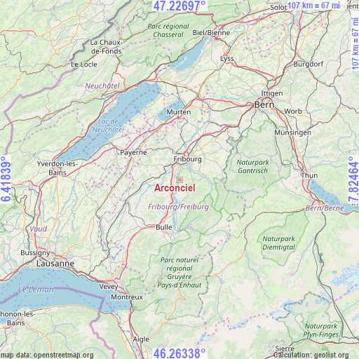
Arconciel GPS coordinates[2]
46° 44' 50.388" North, 7° 7' 17.472" East
| Map corner | latitude | longitude |
|---|---|---|
| Upper-left | 47.22697°, | 6.41839° |
| Center: | 46.74733°, | 7.12152° |
| Lower-right: | 46.26338°, | 7.82464° |
| Map W x H: | 107.1×107.1 km | = 66.5×66.5mi |
| max Lat: | 47.76737° ⇑76.7% North |
| Arconciel: | 46.74733° |
| min Lat: | ⇓23.3% South 45.83203° |
| min Long | Arconciel | max Long |
| 5.97153° | 7.12152° | 10.44624° |
| W 15.7%⇐ | ⇒84.3% E |
Elevation
Elevation of Arconciel is 710 m = 2329 ft, and this is 151.8 m = 498 ft above average elevation for this country.
| Max E: |
1845 m = 6053 ft | 16.7% |
| Arconciel | 710 m 2329 ft | |
| Avg. | 558.2 m = 1831 ft | |
Min E: |
197 m = 646 ft | 83.3% |
See also: Switzerland elevation on elevation.city.
Geographical zone
Arconciel is located in North temperate zone (between Tropic of Cancer and the Arctic Circle). Distance of this North polar circle is 2203.4 km =1369.1 mi to North.| Distance of | km | miles | from Arconciel |
|---|---|---|---|
| North Pole | 4809.2 | 2988.3 | to North |
| Arctic Circle | 2203.4 | 1369.1 | to North |
| Tropic Cancer | 2591.9 | 1610.5 | to South |
| Equator | 5197.8 | 3229.8 | to South |


Nearby cities:
15 places around Arconciel: (largest is in red/bold)
• Autigny
7.8 km =4.8 mi,  261°
261°
• Avry-sur-Matran
6.1 km =3.8 mi,  317°
317°
• Corminboeuf
7.1 km =4.4 mi,  350°
350°
• Ecuvillens
3.2 km =2 mi,  291°
291°
• Ependes
2 km =1.2 mi,  69°
69°
• Fribourg
6.5 km =4 mi,  20°
20°
• Giffers
6.8 km =4.2 mi,  75°
75°
• Givisiez
7.2 km =4.5 mi,  2°
2°
• La Roche
5.8 km =3.6 mi,  168°
168°
• Marly
4.6 km =2.9 mi,  45°
45°
• Matran
4.7 km =2.9 mi,  337°
337°
• Pont-la-Ville
5.6 km =3.5 mi,  188°
188°
• Praroman
4.3 km =2.7 mi, 83°
• Treyvaux
2.5 km =1.6 mi,  150°
150°
• Villars-sur-Glâne
4.8 km =3 mi,  356°
356°
Sources, notices
• [Note1] Compared only with cities in Switzerland existing in our database
• [Src1] Map data: © OpenStreetMap contributors (CC-BY-SA)
• [Src2] Other city data from geonames.org with taken over terms of usage.
• [Src3] Geographical zone / Annual Mean Temperature by Robert A. Rohde @ Wikipedia
