Le Grand-Saconnex geodata
Le Grand-Saconnex (Geneva) is a populated place; located in Switzerland in Europe/Zurich (GMT+2) time zone. With population of 9,781 people, there are 158 cities with bigger population in this country. Compared to other cities in Switzerland, 93.1% of cities are located further ↑North; 99.3% of cities are located further →East and 62.7% of cities have higher elevation than Le Grand-Saconnex. Note1


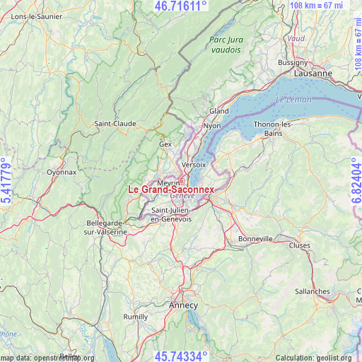
Le Grand-Saconnex GPS coordinates[2]
46° 13' 54.768" North, 6° 7' 15.276" East
| Map corner | latitude | longitude |
|---|---|---|
| Upper-left | 46.71611°, | 5.41779° |
| Center: | 46.23188°, | 6.12091° |
| Lower-right: | 45.74334°, | 6.82404° |
| Map W x H: | 108.2×108.2 km | = 67.2×67.2mi |
| max Lat: | 47.76737° ⇑93.1% North |
| Le Grand-Saconnex: | 46.23188° |
| min Lat: | ⇓6.9% South 45.83203° |
| min Long | Le Grand-Saconn | max Long |
| 5.97153° | 6.12091° | 10.44624° |
| W 0.7%⇐ | ⇒99.3% E |
Elevation
Elevation of Le Grand-Saconnex is 450 m = 1476 ft, and this is 108.2 m = 355 ft below average elevation for this country.
| Max E: |
1845 m = 6053 ft | 62.7% |
| Avg. | 558.2 m = 1831 ft | |
| Le Grand-Saconnex | 450 m = 1476 ft | |
Min E: |
197 m = 646 ft | 37.3% |
See also: Switzerland elevation on elevation.city.
Geographical zone
Le Grand-Saconnex is located in North temperate zone (between Tropic of Cancer and the Arctic Circle). Distance of this North polar circle is 2260.7 km =1404.7 mi to North.| Distance of | km | miles | from Le Grand-Saconnex |
|---|---|---|---|
| North Pole | 4866.6 | 3024 | to North |
| Arctic Circle | 2260.7 | 1404.7 | to North |
| Tropic Cancer | 2534.6 | 1574.9 | to South |
| Equator | 5140.5 | 3194.2 | to South |


Nearby cities:
15 places around Le Grand-Saconnex: (largest is in red/bold)
• Bellevue
3.8 km =2.4 mi,  42°
42°
• Carouge
5.8 km =3.6 mi,  166°
166°
• Chêne-Bougeries
6.3 km =3.9 mi,  126°
126°
• Chêne-Bourg
6.9 km =4.3 mi, 125°
• Confignon
7.1 km =4.4 mi,  203°
203°
• Genève
3.8 km =2.4 mi,  149°
149°
• Lancy
4.7 km =2.9 mi,  186°
186°
• Les Avanchets
1.5 km =0.9 mi,  220°
220°
• Meyrin
3.1 km =1.9 mi,  274°
274°
• Onex
5.5 km =3.4 mi, 194°
• Plan-les-Ouates
7.1 km =4.4 mi,  182°
182°
• Satigny
6.8 km =4.2 mi,  253°
253°
• Vandœuvres
6.4 km =4 mi,  100°
100°
• Vernier
3.2 km =2 mi,  239°
239°
• Versoix
6.6 km =4.1 mi,  28°
28°
Sources, notices
• [Note1] Compared only with cities in Switzerland existing in our database
• [Src1] Map data: © OpenStreetMap contributors (CC-BY-SA)
• [Src2] Other city data from geonames.org with taken over terms of usage.
• [Src3] Geographical zone / Annual Mean Temperature by Robert A. Rohde @ Wikipedia
